|
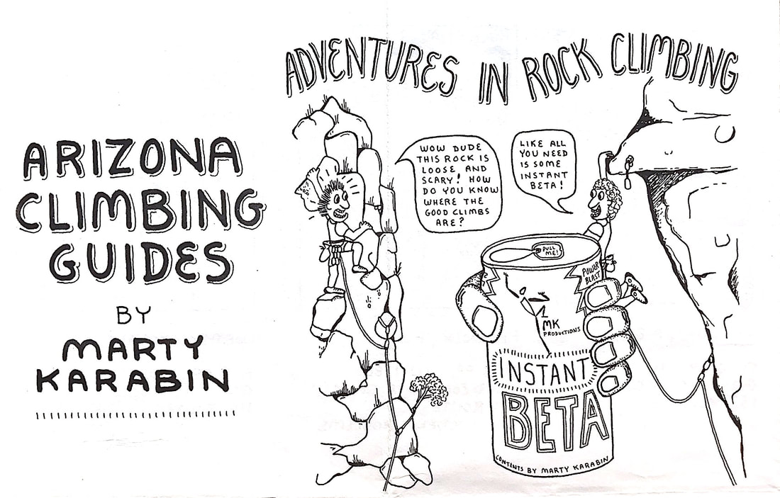
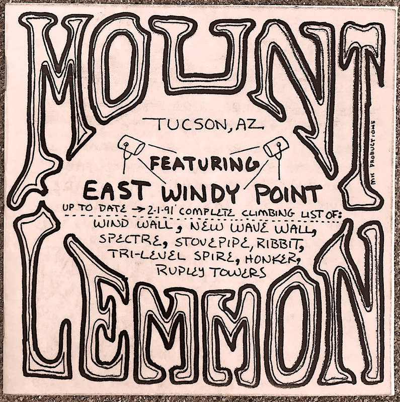
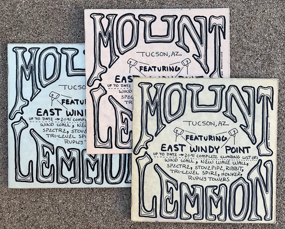
The first rock climbing guidebook I created is Mount Lemmon in February 1991. 18 pages that were created using a Xerox copy machine at my workplace. The cover is colored parchment paper that is coated with clear shelf paper. I used a spatula to get the shelf paper to adhere as best it could. I only had a small stapler so I used a cardboard box as a base as I pushed the open staples in, then afterwards I bent the
|
|
MK Mount Lemmon guidebook |
staples individually by hand. Three different color covers and 200 guidebooks were made. As I was hanging out at the guard rail along the road at Windy Point gathering further information for the guidebook, a person approached me and asked me what I was doing. I showed him my paper notes and then on the spot he proceeded to fill in the missing information I was seeking for the guide. I was totally amazed this person knew the area so well and I was very thankful. He wished me good luck on creating my guidebook then said his name was Eric Fazio-Rhicard. Soon after my guidebook was completed and in a few climbing stores, Eric's first edition of the Mount Lemmon guidebook became available. It is really inspiring that Eric helped me create my first guidebook, while not even saying that his guidebook was in print at that time. Later I found Eric's Mount Lemmon supplement guide created January 1989.
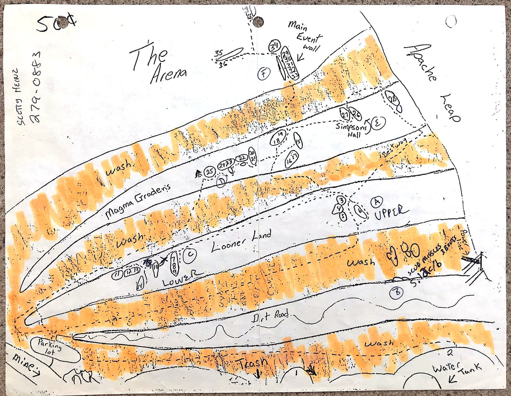
Scott Hynes 50 cents paper guide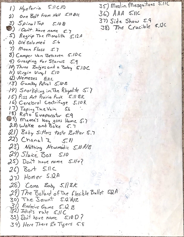
|
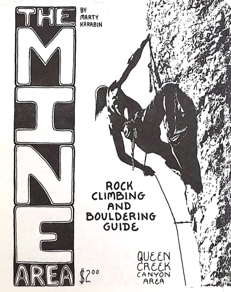
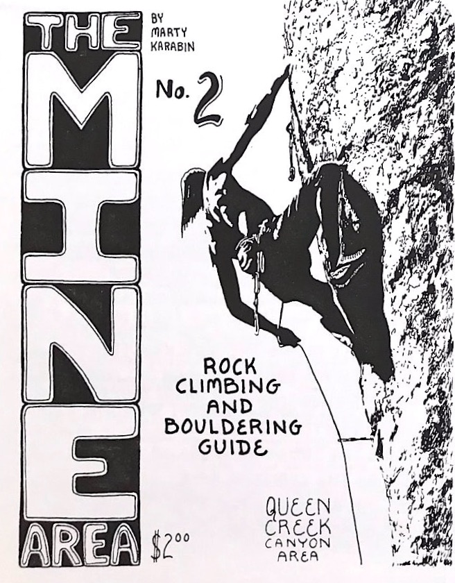
In the late 1980s I was beginning to develop routes in Queen Creek Canyon near Superior AZ. At that time there was a lot of rock to be explored and as new routes were being developed I collected the information for a future guidebook that I had in mind. Many groups of explorers were bolting routes which was the beginning of the Mine Area, Euro Dog Valley, and Upper and Lower Devils Canyon. Queen Creek Canyon Road Area only had a dozen routes overall at that time. There was mention of Queen Creek Canyon in the Phoenix Rock book by author Jim Waugh, but still Queen Creek was slow on new development. Jim eventually moved the Phoenix Bouldering Contest to the Oak Flat campground in 1996 which brought more attention to the unlimited climbing possibilities the Queen Creek Canyon area had to offer. A climber name Scott Hynes in 1988 offered to the public a paper guide to the Mine Area costing 50 cents. Most of the climbers at that time were visiting a area named Zonerland and were developing amazing routes on the many pinnacles the Superstition Mountain Wilderness has to offer. However Zonerland required a long hike where the Mine Area at Queen Creek was only a ten minute approach. My attention was set on Queen Creek Canyon and the Mine Area.
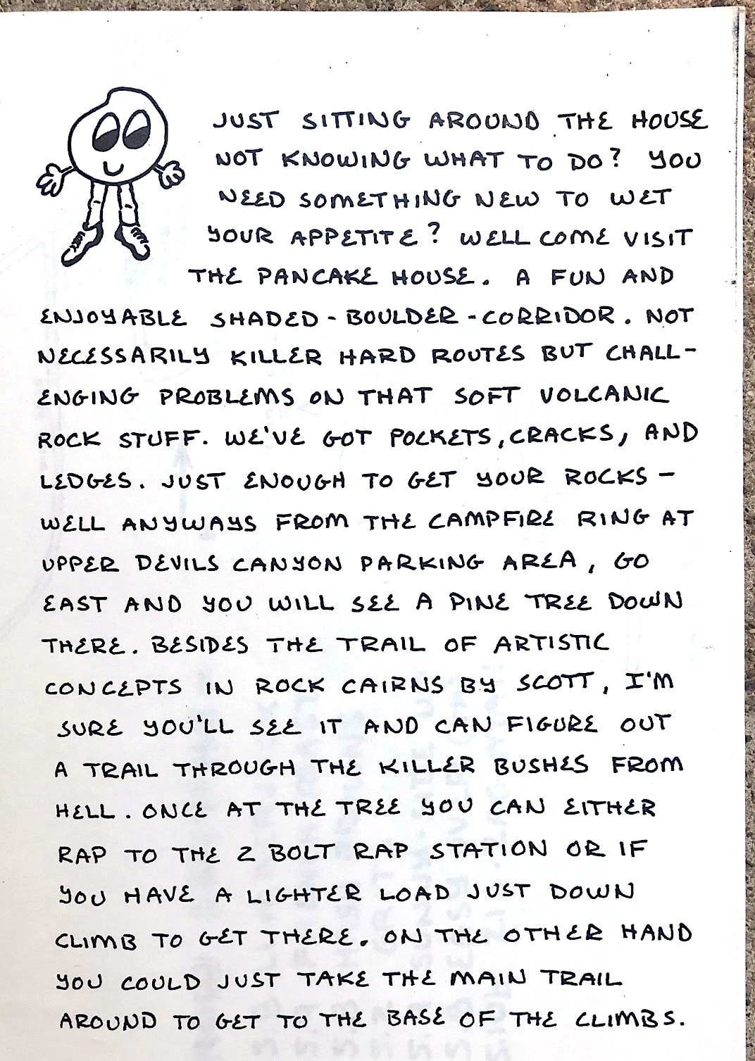
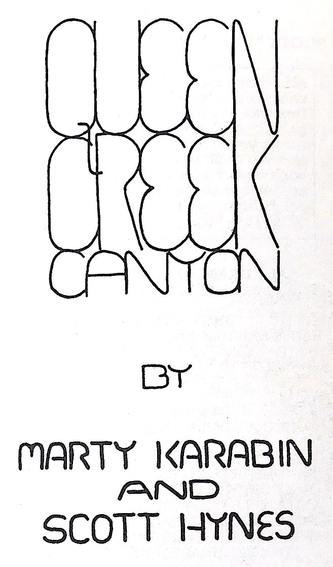
I teamed up with Scott Hynes and started putting a together a guidebook for the area. During that time a climber named Rich LeMal took me to his secret climbing area named Upper Devils Canyon, and I was instantly in love with the canyon. Myself, my climbing partner Harvey Delos Reyes and Rich began developing routes and naming the areas, one fun area being the Pancake House. The Pancake House is a awesome corridor that is shaded throughout the day. While other climbing groups were developing other areas, Upper Devils Canyon remained a secret due to the many walls and adventures it had to offer. Plus the canyon was filled with wildlife. |
In 1989 Zonerland became a issue that suddenly was nation wide. Instantly a bolting ban went into effect in all Wilderness areas throughout the United States. The overall Wilderness Act was established in 1964, but wasn't a issue at that time with rock climbers. But when climbing fixed anchors were becoming more used, rock climbing became a major issue. I find it really wild that the overall Wilderness bolting issue started right here in Arizona in the Superstition Mountains. So since the Superstition Mountains became off limits for any additional fixed anchors, more attention went to the Queen Creek Canyon area.
|
Since there was little written information to the Zonerland area I started going out there to climb the routes and create a mini guide to the area. I have to say the rock quality in the Zonerland area is totally fantastic!!! The routes are still allowed to be climbed, but no further bolting was allowed. November 1990 I scratched down what little information I had on the Zonerland area and shared it, then returned my sights to the rock walls in Queen Creek. In January 1991 a supplement guide to the Superstition Mountains became available created by Rick Percival.
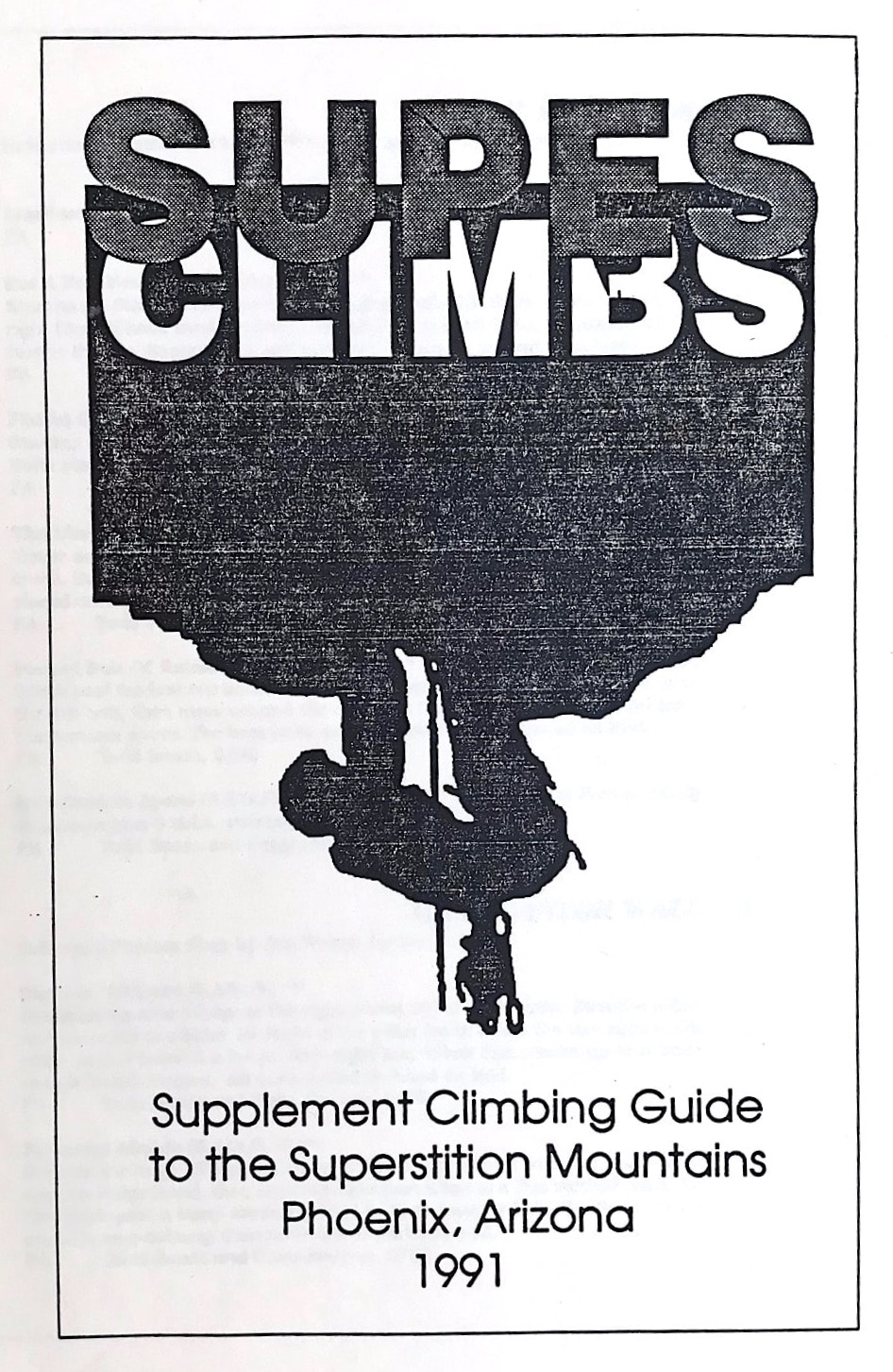
Supes Climbs by Rick Percival |
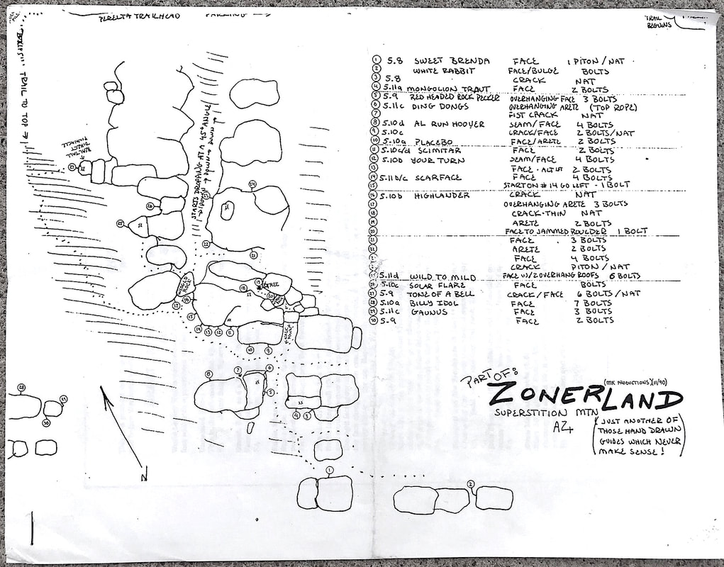
MK Zonerland mapIt was nice to be back in Upper Devils Canyon. Nobody even knew of the area and it felt like it was our own personal canyon to explore. We put most of our attention on The Throne area and Pancake House area. During this time as well we continually visited the Overlook in Oak Creek Canyon enjoying the many 100' tall awesome Basalt cracks. I became really good at crack climbing at the Overlook as it became and still is one of my favorite climbing areas. On Memorial Day 1991 my climbing partners sister brought along her friend Randi on a campout to the Overlook, and Randi became my girlfriend and eventually my wife. At that time Randi just moved to AZ and started a job at a publishing company being a creative assistant in designing magazines.
Scott and I continued to collect information and began writing the Queen Creek Canyon guidebook. During this time I was so excited for Queen Creek and developing the Pancake House that I created a Pancake House guidebook for my close friends in June 1991. 10 pages on Xerox copy paper and 5 copies of the book were made. Most of the names of the routes inside the Pancake House are foods served at Breakfast time. |
|
This was a exciting time for the Queen Creek area as new routes were going up everywhere. It was interesting to see how each group of climbers found their own areas that they enjoyed developing. At that time Lower Devils canyon was being developed and I remember going there traveling past the windmill and parking at the end of the road with a simple two wheel drive pickup truck. Soon after that a four wheel drive vehicle became mandatory. The mining company was no longer grading the road but I still could drive my 2WD van up and park it on top of the first hill.
|
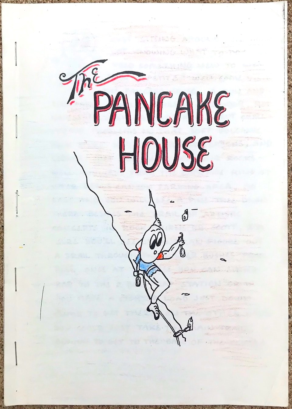
MK Pancake House Guide |
Cairns by Harvey"Scott"Delos Reyes
|
|
My girlfriend Randi was a huge help in the creation of the Queen Creek Canyon guidebook. I had no idea on how books were even given to the publisher to be printed. She knew the whole process and helped throughout. I want to share a lot of stuff in the two Queen Creek Canyon guidebooks that were created, so I added a link button to jump to a separate page for the complete information about the books.
|
|
|
|
|
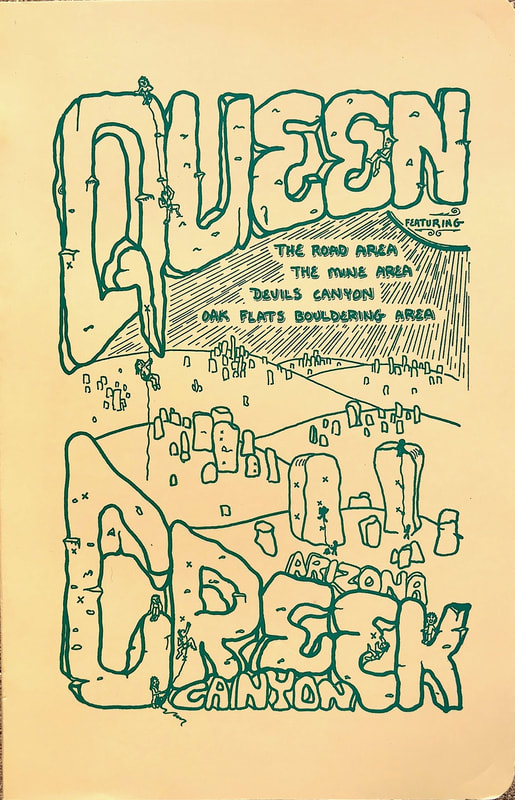
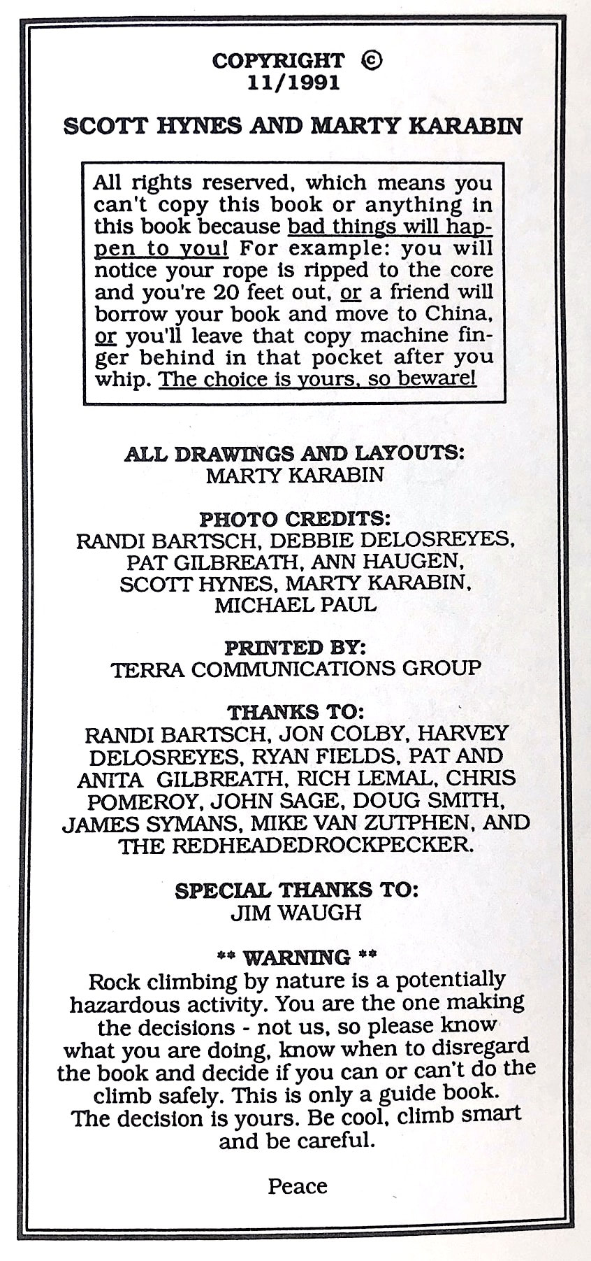
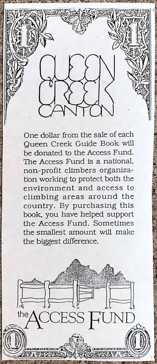
November 1991 the book was completed and was being sold in the climbing stores all over AZ. It was really exciting to be involved in the whole process of creating a large guidebook. Scott shared in collecting the overall route information and wrote many of the area information tidbits in Scotty lingo. My part was creating the one hundred or so drawings, the layout, and learning to not get frustrated with Scott's silly demands. One dollar from each book sold went as a donation to the Access Fund. Overall 1000 books were printed and it came to a total of 198 pages. As simple as the book turned out, it to me was the first stage to a upcoming second Queen Creek Canyon guidebook that I already could see was going to be a masterpiece. The printing of the book is the first stage of the book process. Then comes the second stage of making sure the books sell and don't sit around as they become outdated.
|
|
|
|
In 1992 Randi and I traveled to North Carolina in the fall and visited the beautiful smokey mountains. While there I stopped in a climbing store and asked if I could get some information for any climbing area to climb for a half day. The store offered a expensive book to me and said that is all
|
12/1992 |
6/2003 |
10/2008 |
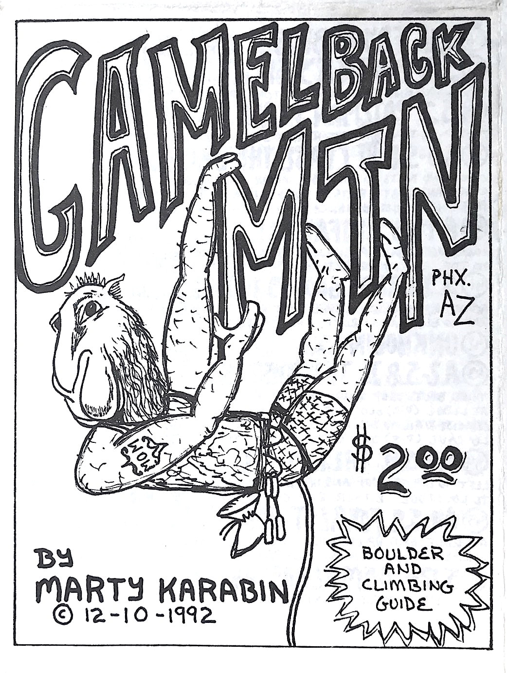
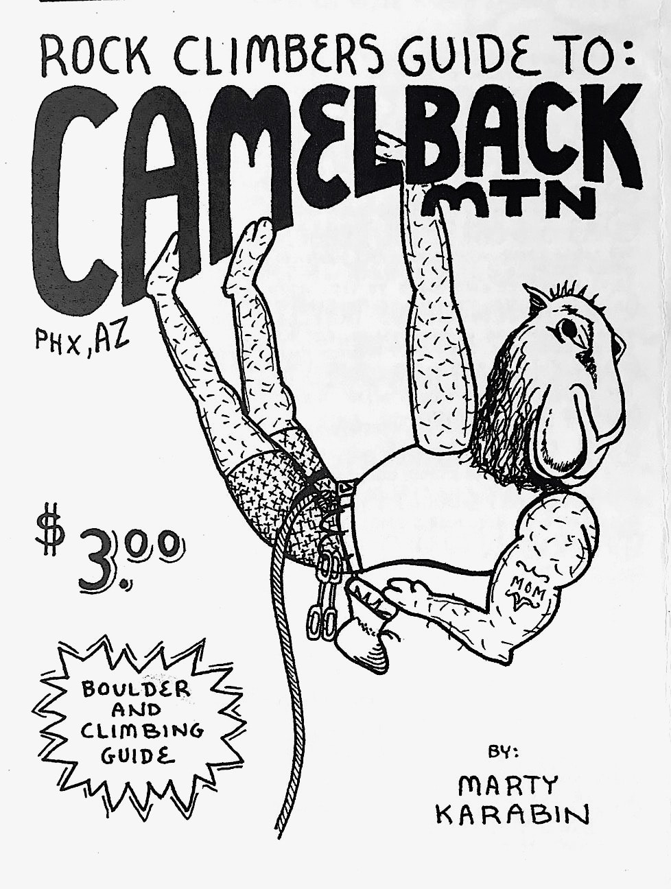
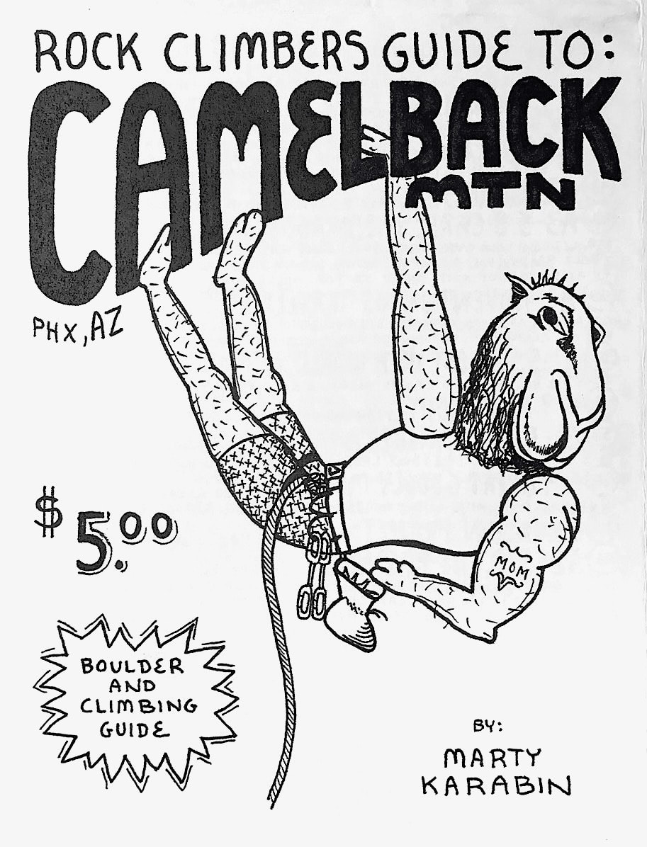
they had. The store employee was not willing to give me any scrap of information which I found to be weird. At that time I just wished there was some way I could purchase a smaller inexpensive guide that traveling climbers will be able to use. So I came up with the idea of creating “Mini Guides.” The challenge was to put all of the information on a single sheet of paper and create a fun climbing cover drawing that people would want to collect. December 1992 I created my first Mini Guide to Camelback Mountain. The mini guide is first completely drawn in pencil to make sure all of the information fits within the 11 x 17 piece of paper. For the Camelback guide and the Pinnacle Peak guide, I did not have a light board to use to redraw the entire guide from pencil to ink, so I taped the papers together on my home patio door and while the sun was the strongest outside, I would stand and redraw the guides using the sunlight for the light like a light board. Poor man’s process for sure, but it totally worked!!!! From the pencil drawing came the first ink proof, then I would redraw it entirely again in ink to perfect the drawings. So yes each mini guide I have created, is actually drawn three times by hand to perfect it.
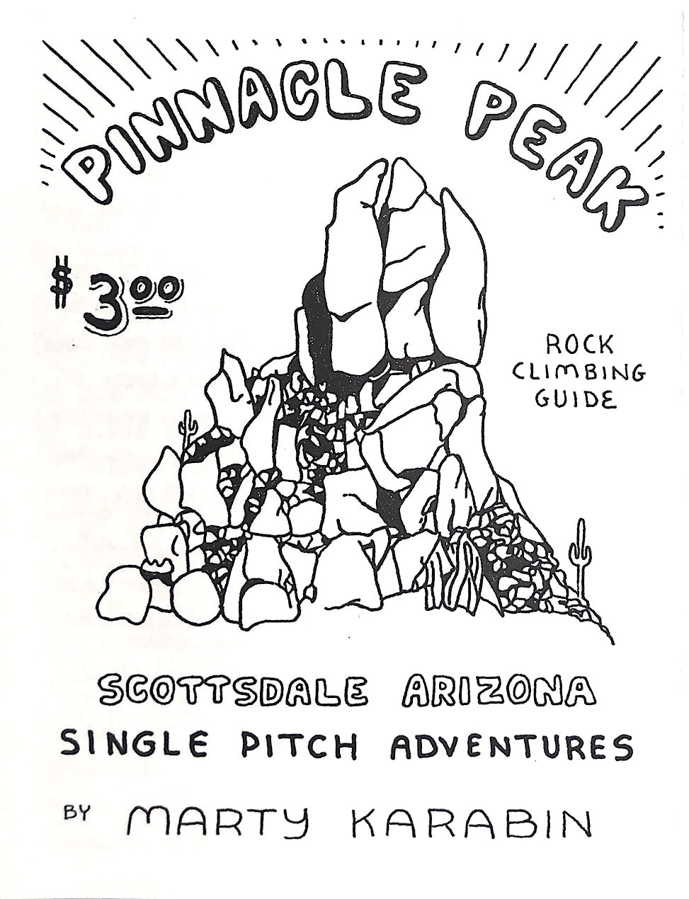
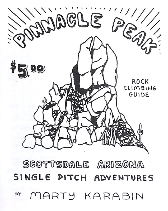
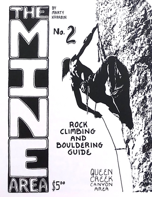
As I reprinted the guides I updated the information contained within. The retail cost was only $2.00. Over the years as the cost of printing went up the price rose to $3.00. Then during the 2008 recession the cost of printing went up enormously forcing the guides to retail at $5.00 each. In 2016 the stores demanded that I add a UPC barcode to all of the maps, so all of the maps were reprinted once again.
As I reprinted the guides I updated the information contained within. The retail cost was only $2.00. Over the years as the cost of printing went up the price rose to $3.00. Then during the 2008 recession the cost of printing went up enormously forcing the guides to retail at $5.00 each. In 2016 the stores demanded that I add a UPC barcode to all of the maps, so all of the maps were reprinted once again.
|
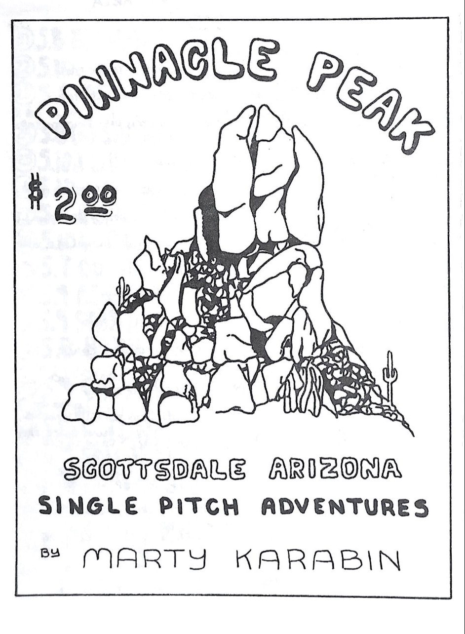
The Camelback guide was a lot of fun to create so I moved on to creating Pinnacle Peak. Most of my early climbing was on routes at Pinnacle Peak. I remember back in the late 1980s my friend Harvey would 4WD his Jeep up to the base of YCrack boulder so we could listen to tunes while we were climbing.
|
1/1993 |
6/2002 |
6/2008 |
late 1992 Ken Mills guide |
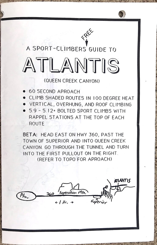
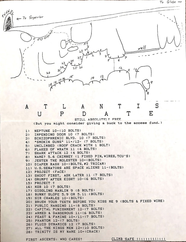
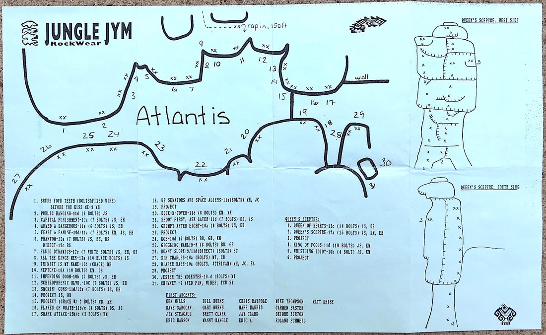
In late 1992 the Atlantis area in Queen Creek canyon was being developed and a guide to the area became available at the climbing stores and the Phoenix Rock Gym. I am not exactly sure who created these guides, maybe Ken Mills or Dave Sabocan. A second guide named the Atlantis Update came out at the end of 1993.
|
late 1993 Ken Mills guide |
1/1993 |
6/1994 |
7/2003 |
2/2016 |
|
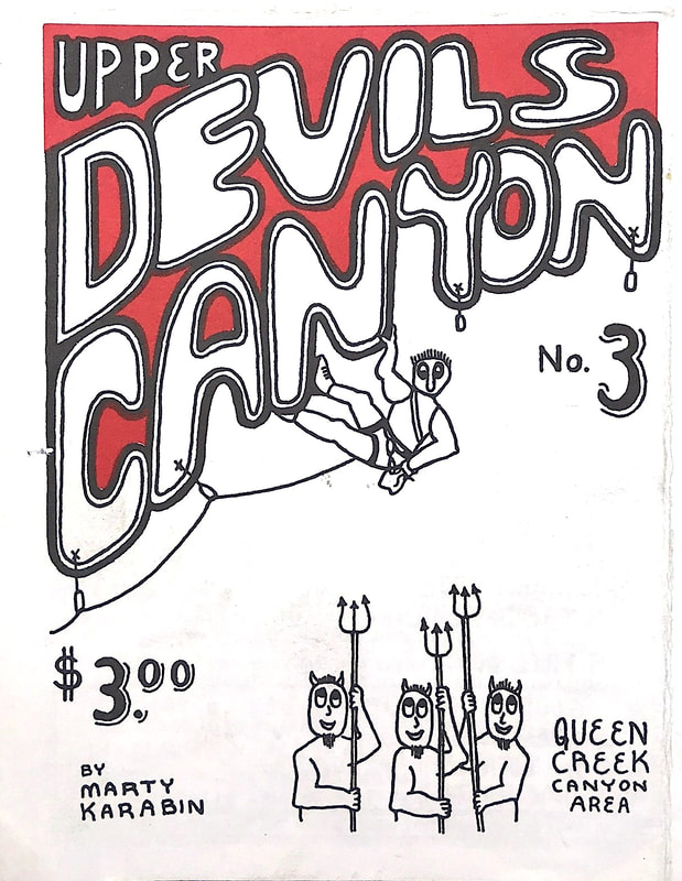
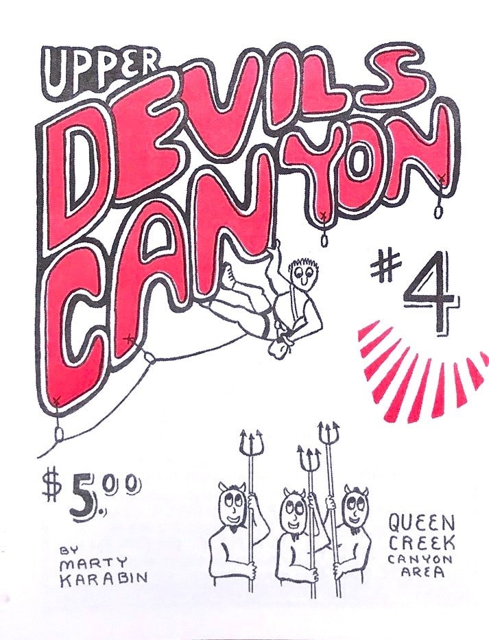
I am not sure if anybody has noticed but in the Upper Devils Canyon #4 guide I included fun words inside the many drawings of the bushes. I call the bushes "rude bushes." I got this idea when creating the second Queen Creek guidebook in 1996 where
|
|
|
throughout the book is around 100 rude bush drawings. The Upper Devils Canyon mini guide #3 is the first guide I created using color on the cover drawing. While at the climbing store looking at all of the guide maps it was hard to see what guides were new since they were all black and white. So color was added to the fun.
|
Upper Devils Canyon was created as a update to the Queen Creek canyon guidebook showing the many new routes created in the canyon. I was climbing a lot with Rich who first introduced me to the canyon. Over time with Rich's help the canyon topped over 100 routes. Back in the early 1990s it was common to see a lot of Javelinas in
|
3/1993 |
11/1994 |
9/2008 |
|
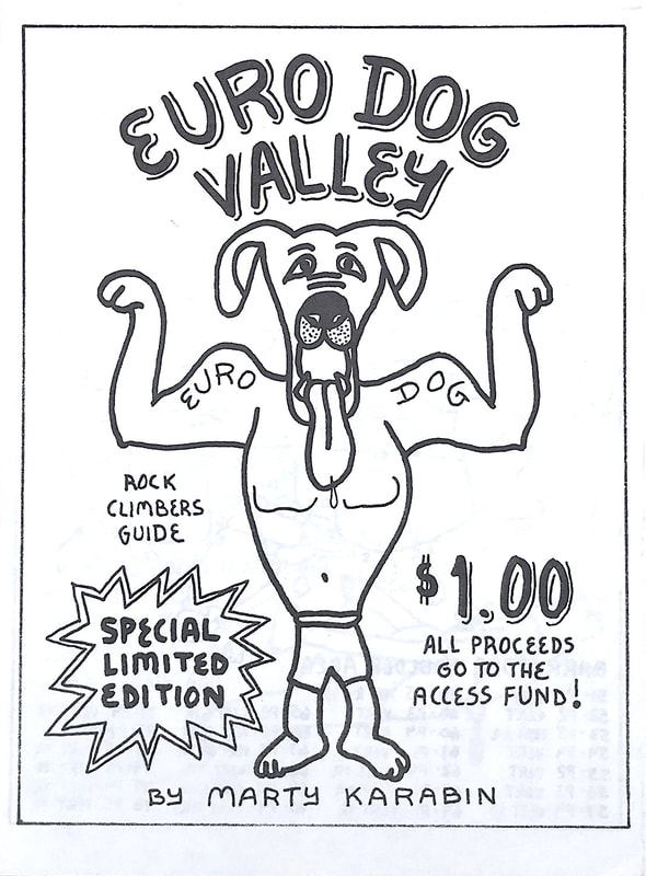
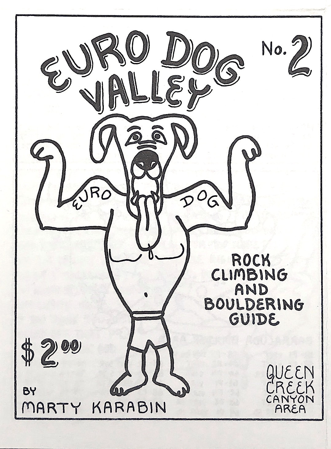
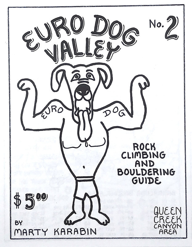
the creek and coyotes on the hillsides. These days the canyon is mostly lizards and an occasional rattlesnake. The first Euro Dog Valley guide I made as a special edition and all proceeds were given to the Access Fund. I believe overall the guide raised $250. A year and a half later the guide was revised and sold in the climbing stores. Presently the Euro Dog Valley guide has many routes, but the boulder problems are rated in the old "P" (Phoenix) system. I still want to revise the Euro Dog Valley guide and only list the routes. This guide only shows half of the overall routes that the canyon actually has today. But unfortunately the actual Mine in the future has planned in filling in this canyon completely with the tailings extracted from the new upcoming mine. In the late 1980s Harvey and I came across many tarantulas in this canyon.
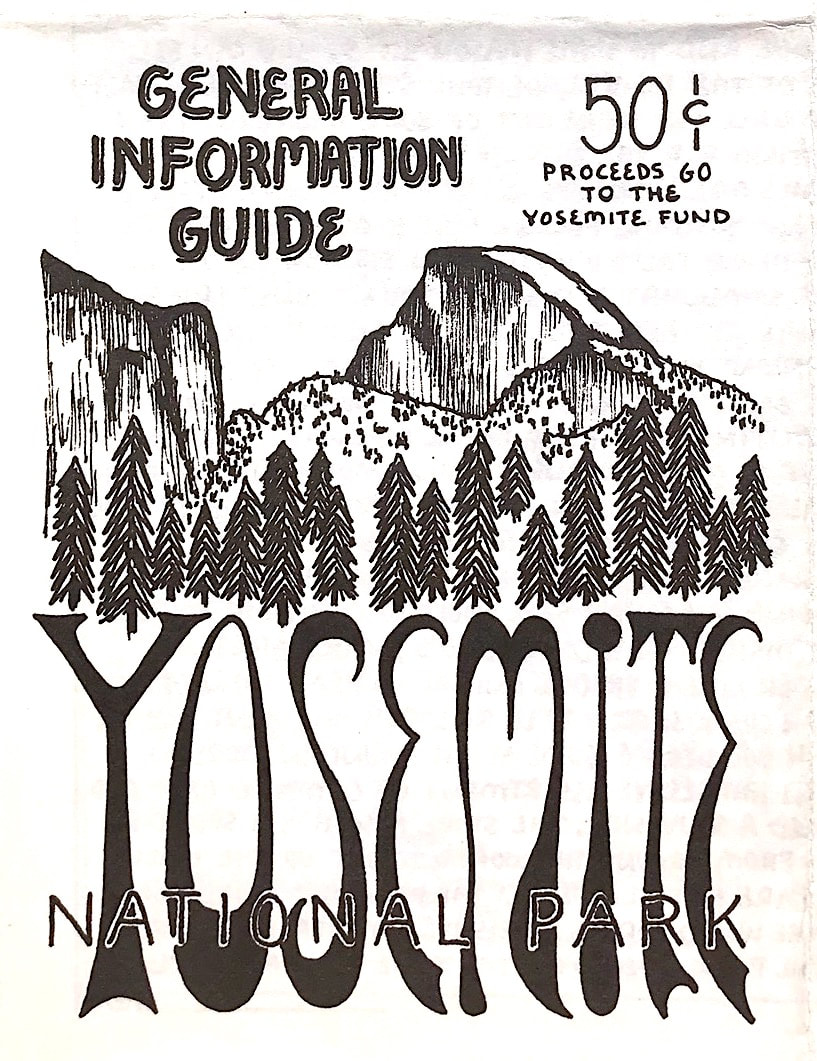
Randi and I visited Yosemite National Park in May 1993 and stayed in a cabin near the Yosemite Falls. It was totally awesome but hard to sleep at night with the waterfall being in full flow. After the visit to the park I created the Yosemite General Information Guide to assist visitors with tips on how to get the most of the National Park if you were there for a short visit. |
5/1993 |
9/1993 |
10/2008 |
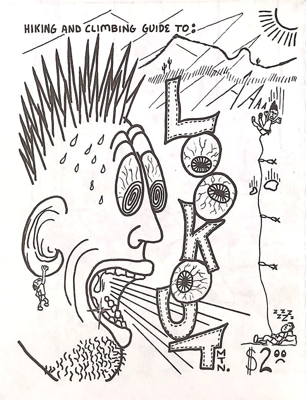
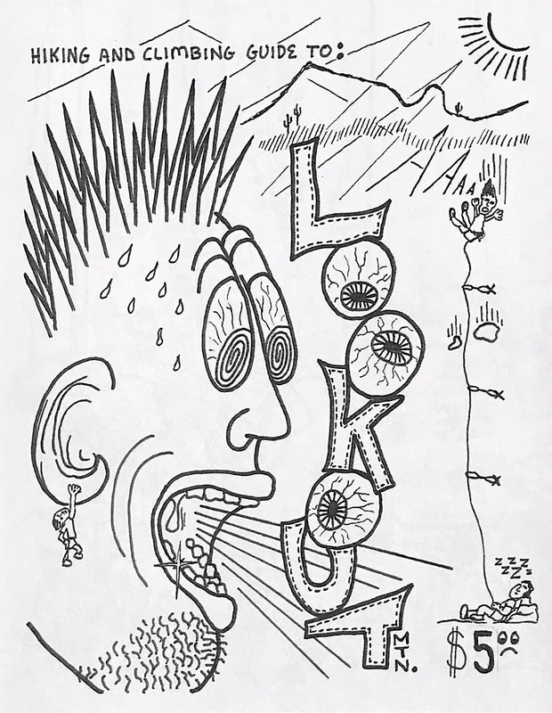
Lookout mountain is a small mountain that is part of the Phoenix Parks system. It has a small wall that is made up of Basalt lava rock mixed in with a composite of different rocks. Luckily for me I used to live only a mile away from the park so many of the mornings I was able to get a few routes in before going to my office furniture job. Eventually I created a guide to the hiking and climbing the mountain has to offer. I only had enough information for one side of the guide, so for the back of the guide I drew a large climbing comic.
|
|
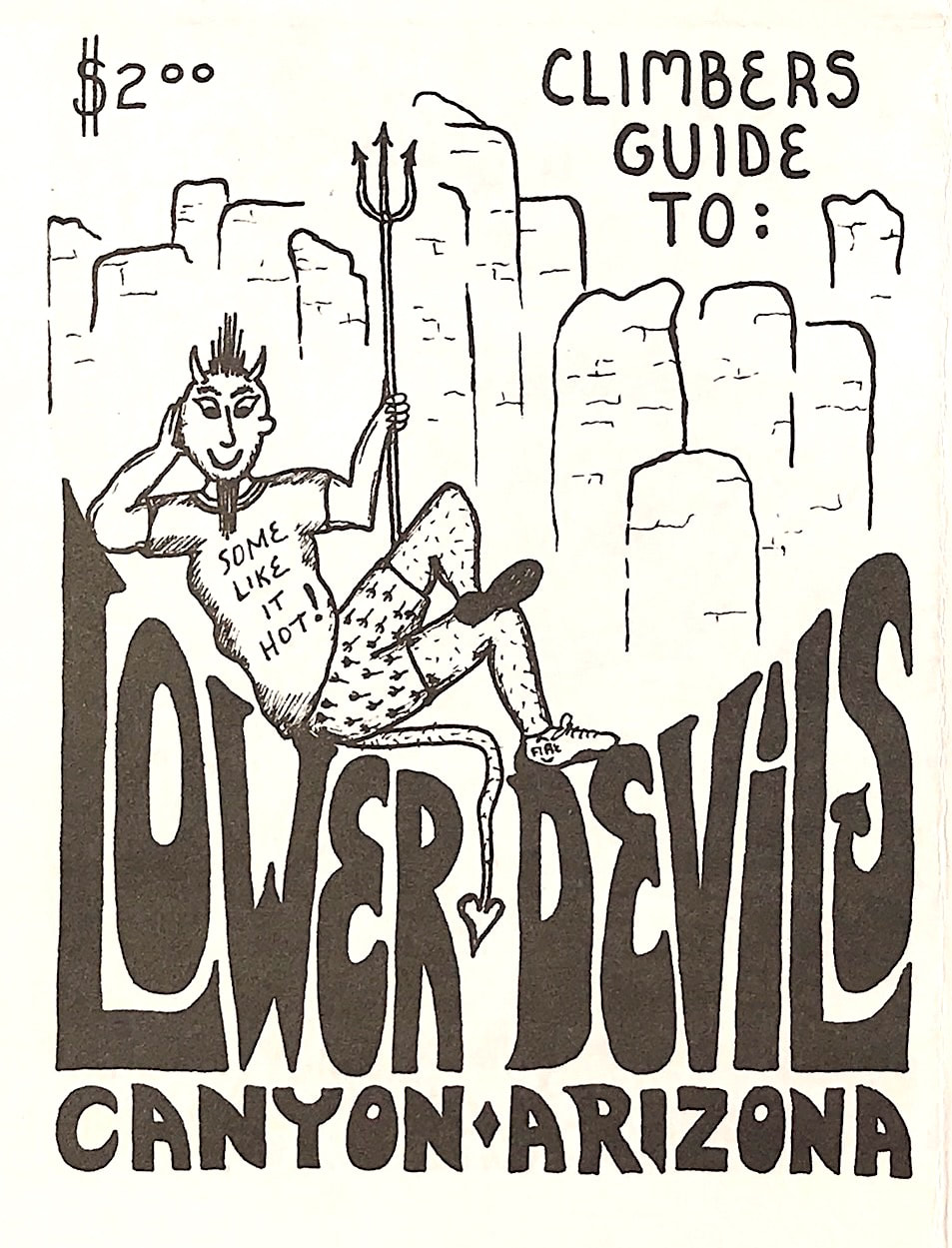
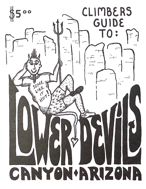
Lower Devils Canyon always provides an adventure to the climbing experience! The rock towers are totally amazing along with the quality of the rock. One summer a mountain lion controlled a few of the routes at the waterfall in Hackberry Creek. On a few adventures while climbing a pair of ringtail cats would get into my pack and steal my lunch right in my view. While creating the drawing of the Damsels in Distress area I had to go to the East side of the creek to get the drawing correct. When returning down into the creek a heard of 50-60 Javelina were walking the creek. Lower Devils canyon has always been a amazing place to explore!
|
10/1993 |
10/2008 |
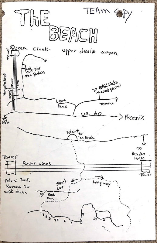
Craig Keaty guide 1/1994 |
January 1994 Craig Keaty created a new guide to the Beach area in Upper Devils Canyon listing the new hard routes he added.
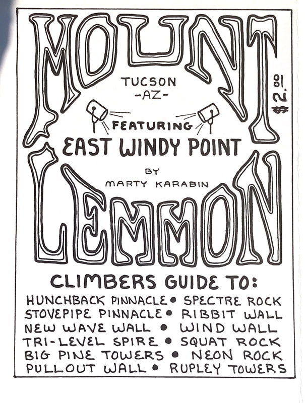
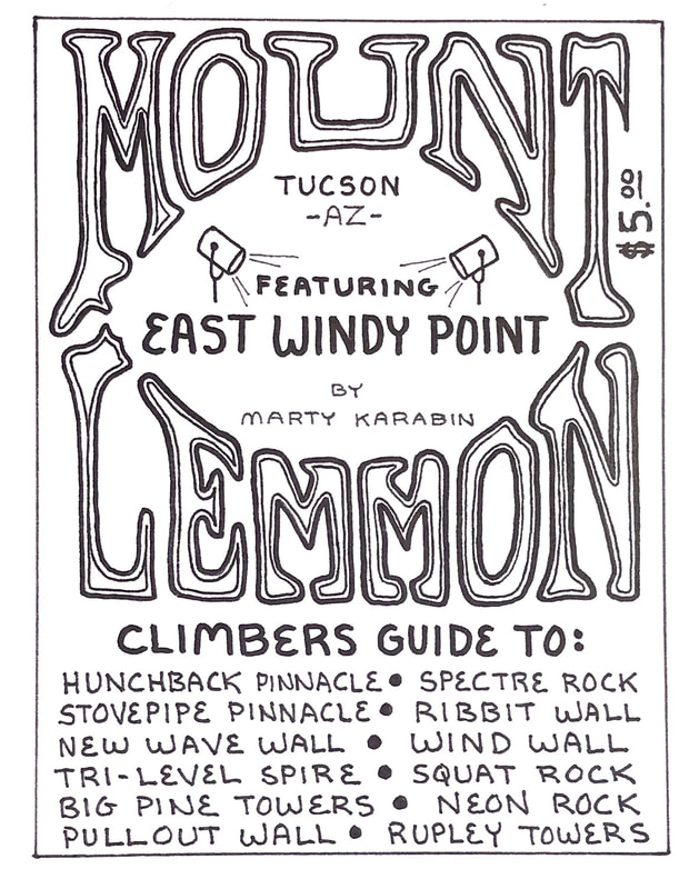
January 1994 I converted the Mount Lemmon MK book to a mini guide format and updated the routes in the East Windy Point area.
|
|
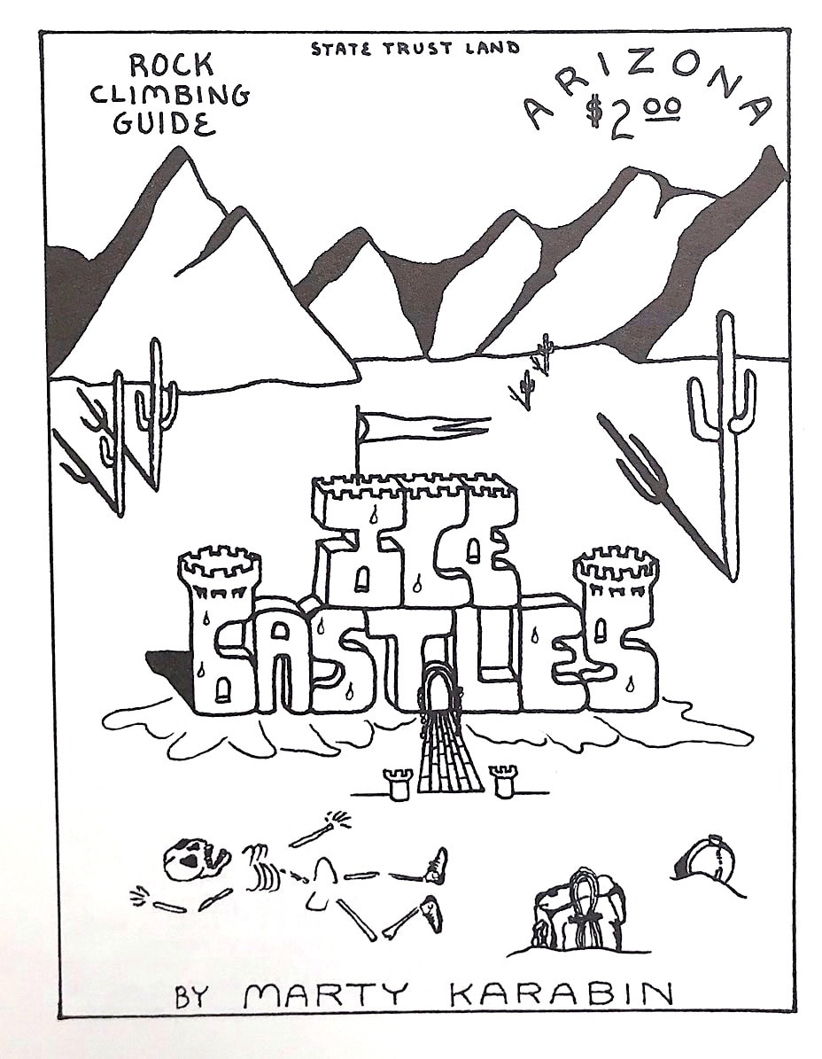
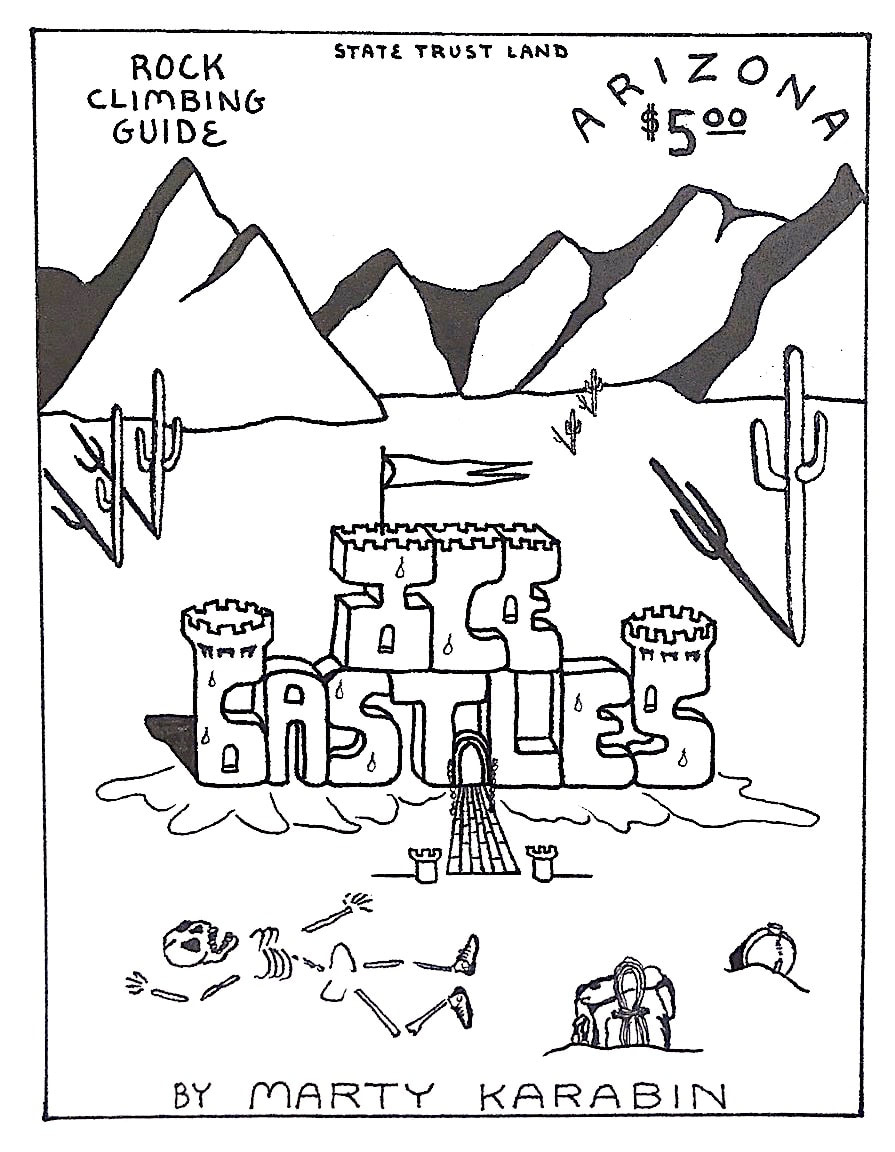
June 1994 I was hanging out a lot in a area called the Ice Castles. The granite rock there is somewhat crumbly and the area is completely littered with gun shells. It is located across the street south from the Ben Avery Shooting Range so I figure that people would rather shoot for free than go to the range. When I state gun shells, I mean the entire road in places were just gun shells and no dirt showing on the road. To me every climbing area is important so I created the Ice Castles guide to create more awareness to other climbers in case the area ever got closed. The more people that knew of the area, the more voices may be able to keep the area open.
|
6/1994 |
10/2008 |
10/1994 |
8/2008 |
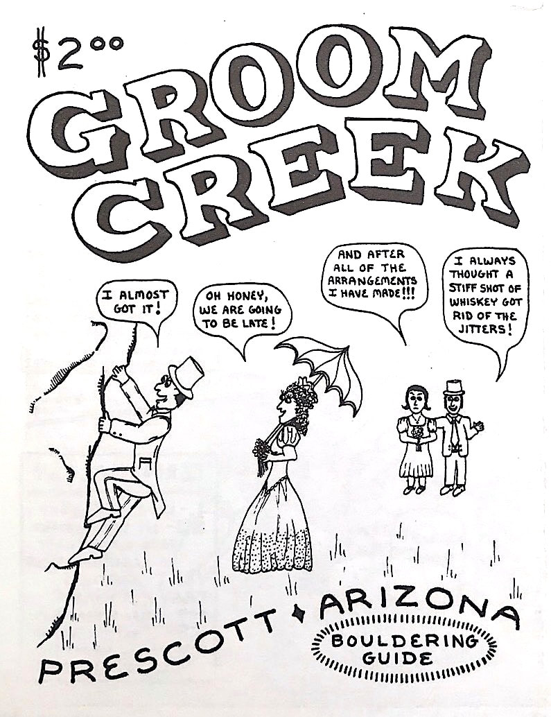
Groom Creek is a totally amazing bouldering area! I created the marriage cover not necessarily for the word "Groom," but since that was the time Randi and I got married. Groom Creek was a challenge to layout since I did not use a top map to create the guide, I did it by using orange construction cones and a compass. Over time the amount of new boulder problems have tripled in the area and now there is not enough room on a 11 x 17 piece of paper to fit all of the information upon. But yet this guide is still highly recommended.
|
|
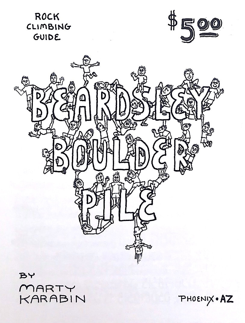
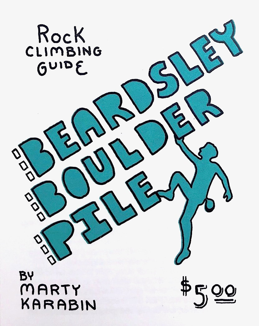
I created the Beardsley Boulder Pile guide in November 1994. At that time there was no other information about the area except for the maps created for the second 1984 and fourth 1986 Central Arizona Bouldering Contest (PBC). The granite rock is sharp but the many boulders with perfect flat landings
|

11/1994 |
9/2008 |
5/2017 |
make the area awesome for bouldering. Further up on the hillside is taller boulders that have fun bolted routes on them. In the 1980s and 1990s we would drive our vehicles up to the boulders and listen to tunes as we were climbing. There were many overnight camping parties in the area which unfortunately brought more smashed glass bottles also to the area. Crash pads were still not invented yet so when I first started climbing at Beardsley there were many large pieces of carpet at the base of the boulders and that was the standard crash pads of that time. We all learned how to fall correctly since a ground fall could become a major injury. I created the guide mainly to create greater awareness of the boulders to other climbers in fear that someday a housing development would shut the area down. Eventually Beardsley became part of the Phoenix Parks system and climbing continues to this day!
|
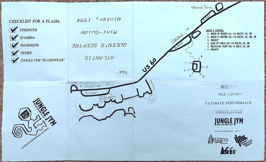
Winter 1994 Jim Steagall and Deidre Burton created a new updated guide to the Atlantis area in Queen Creek canyon. This guide advertises the Jungle Jym Rockwear clothing line that Jim and Deidre created. I had many pairs of the Jungle Jym shorts and they were my favorite climbing clothing overall.
|
Jim Steagall /Deidre Burton |
Winter 1994 |
6/1995 |
3/1998 |
7/2008 |
The Mine Area is a really unique climbing area. I really enjoy how the thimble like pinnacles all gently curve into the ground at the pinnacles base. Super easy trail access to the climbing routes on the shorter rock pinnacles. The Mine Area is where I bolted a few of my very first First Ascents at.
|
3/1996 |
5/2006 |
9/2008 |
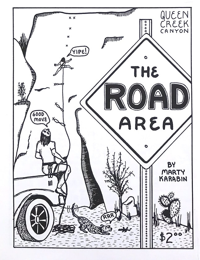
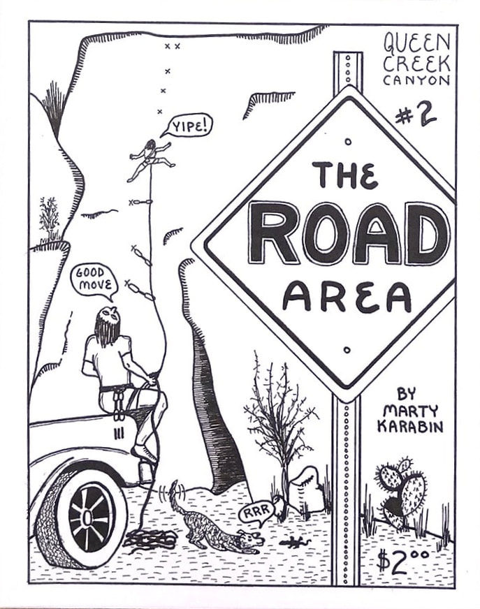
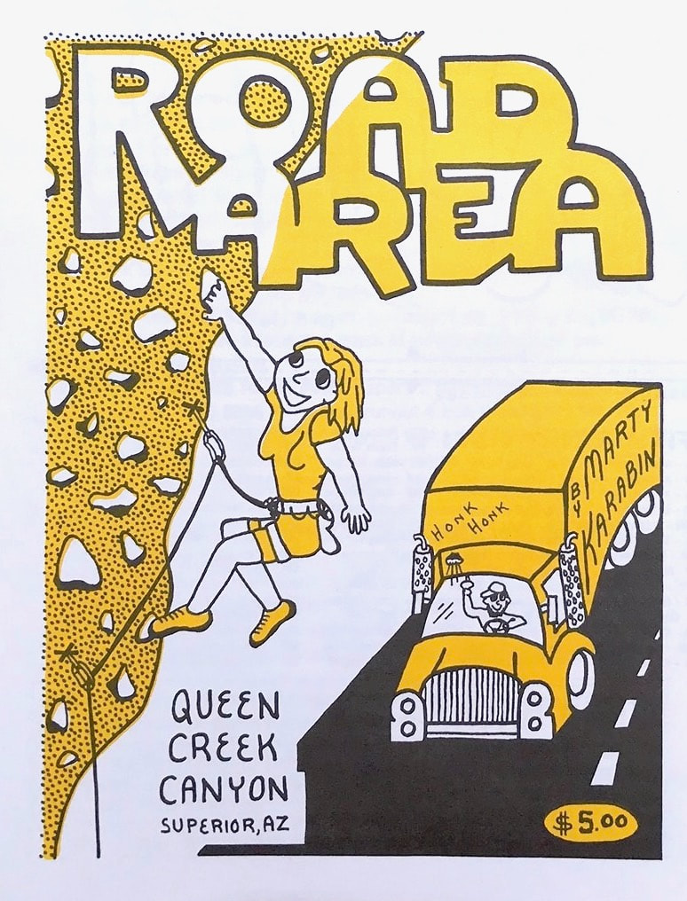
The Road Area sports the two most traveled climbing areas in Queen Creek Canyon, Atlantis and the Pond. Easy access and Atlantis is mostly always in the shade, and the Pond at times has a 80' running waterfall and overlooks Queen Creek. Both areas have many awesome routes and a few 5.13s at the Pond.
|
|
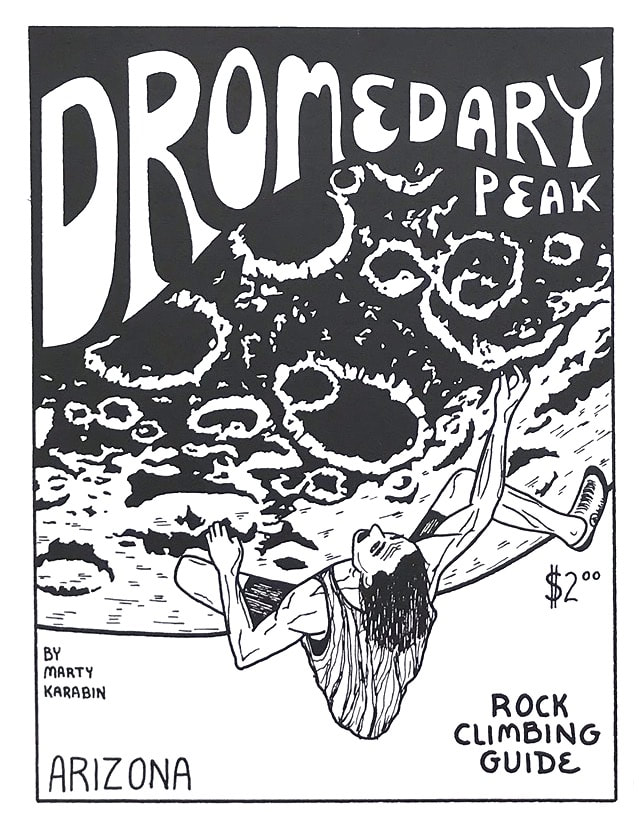
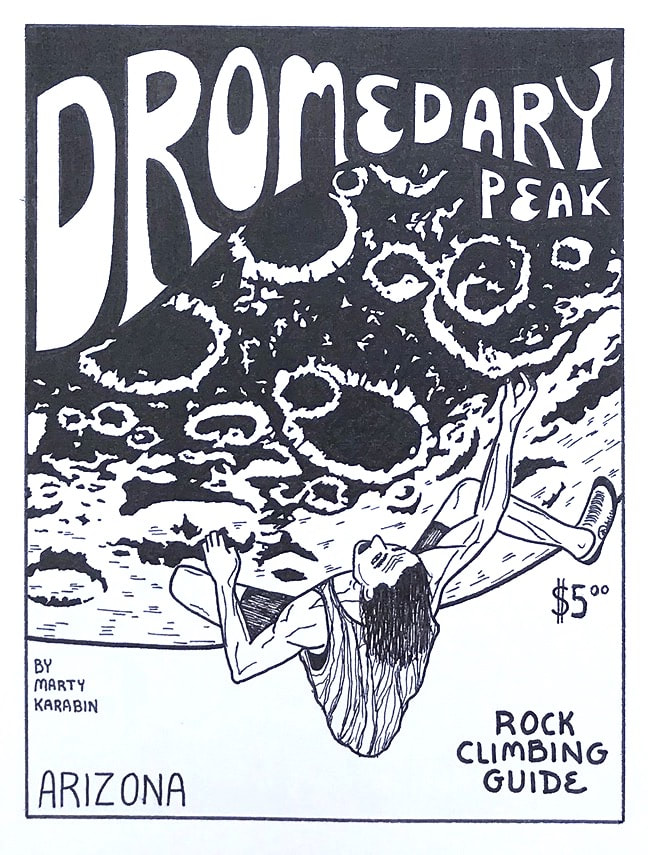
Dromedary Peak is a obvious camel shaped mountain on the road from Phoenix To Superior AZ. It was named Dromedary at the time when the mine in Superior AZ was transporting its ore to the Coke ovens in Florence by horse wagon trains. Somebody came up with the idea that camels would be better to use than the horses, which didn't work out well due to the camels soft feet. The camels were set free to roam between Dromedary Peak and Florence. The rock on Dromedary Peak is exquisite. A super hard Rhyolite and many more routes remain for future climbers to create.
|
3/1996 |
2/2008 |
3/1996 |
1/2006 |
1/2008 |
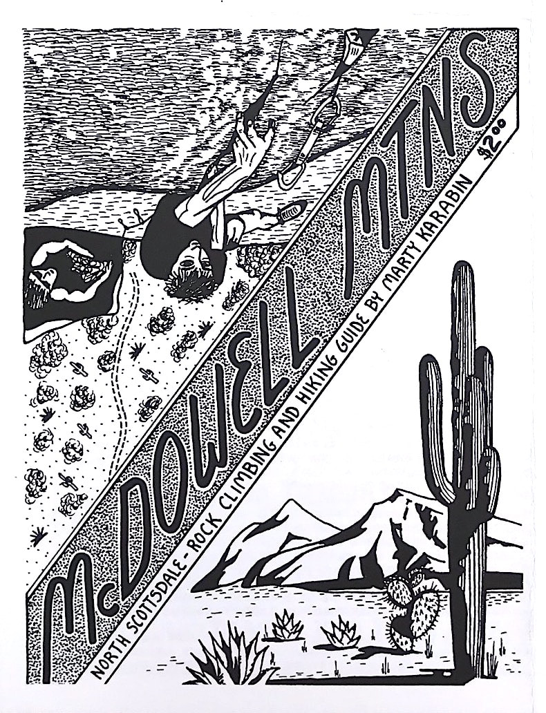
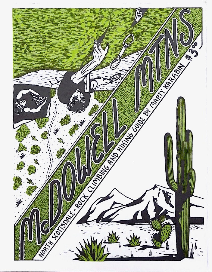
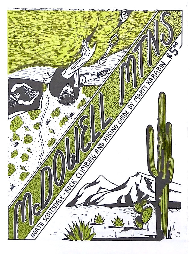
The McDowell Mountains have awesome quality granite routes, and some multi pitch as well. I could not fit the many climbing areas the McDowell Mtns have on a simple 11 x 17 sheet of paper, so I took a few photos of the popular locations climbers visit, and created the guide.
|
|
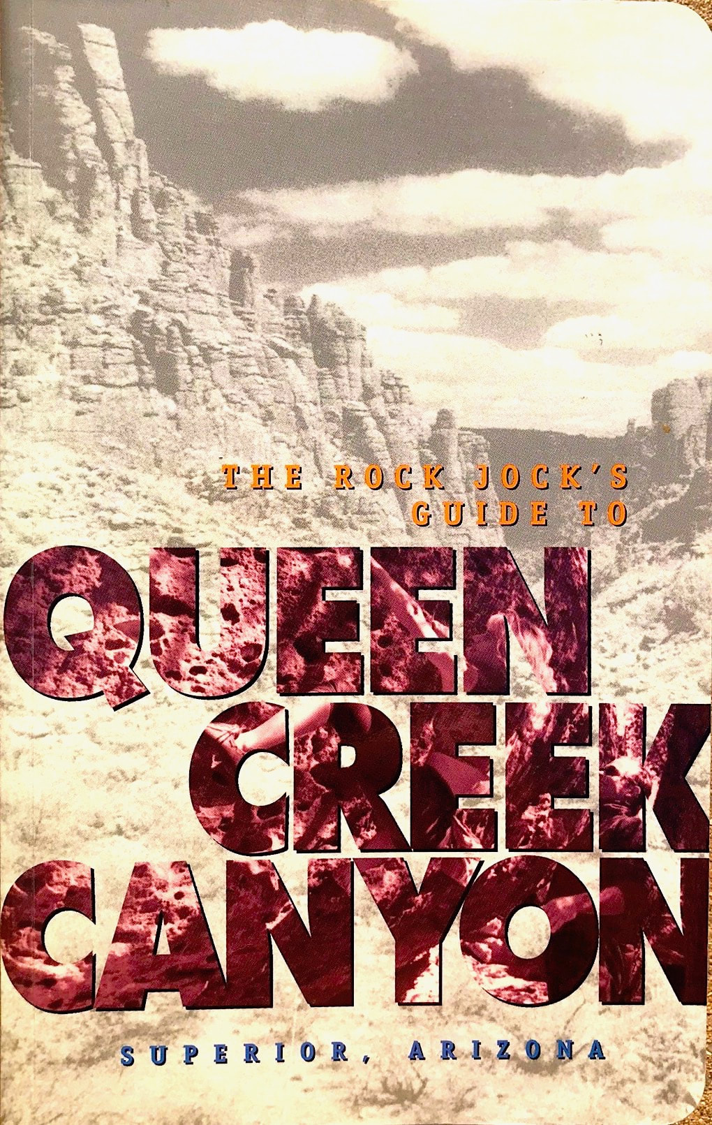
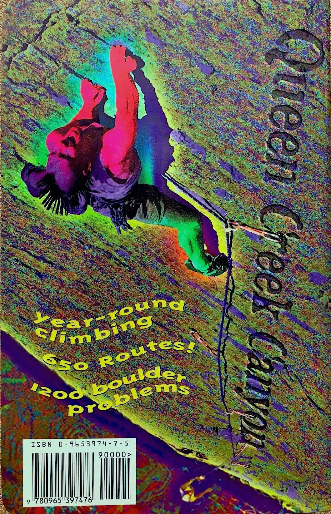
My dream project started at the beginning of 2005 where I began collecting ideas and information on how to proceed on creating a updated version of the Queen Creek Canyon guidebook. Luckily for me I kept collecting information on the Queen Creek canyon area through many of my QC mini guides that covered a good portion of what the book needed as far as the research goes. For this new guidebook to Queen Creek
|
|
canyon I didn't just have in mind creating a newer nice guidebook, I actually went after creating the best guidebook ever produced in the world. I have a lot of cool information to share, and I put it on another page which the link goes to. Throughout the books creation my wife Randi educated me on how to use the computer to get all of the information and photos and illustrations together, then she would toss all of the puzzle pieces together creating the perfect design. My unlimited props go to Randi for all of the work she assisted in making this book a true overall masterpiece. And with many thousands of dollars later, the guidebook was completed 8/1996
|
Marty Karabin |
8/1996 |
11/1997 |
10/2008 |
5/2012 |
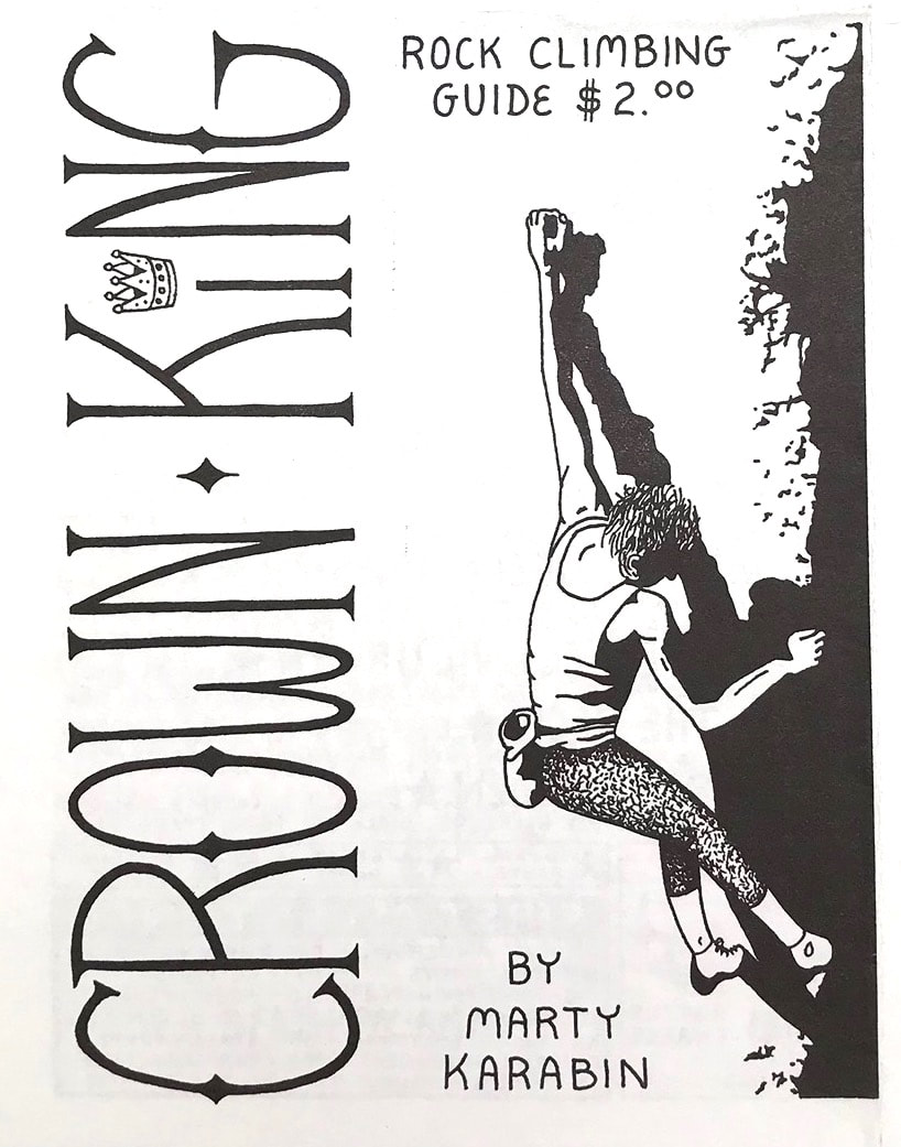
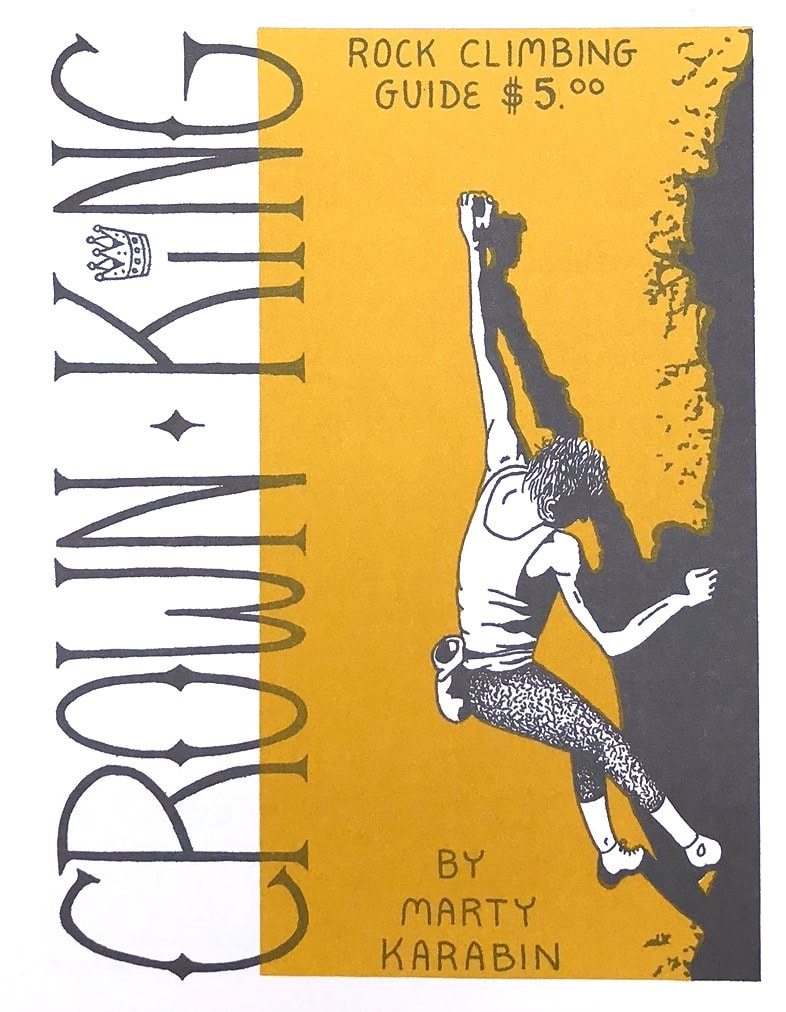
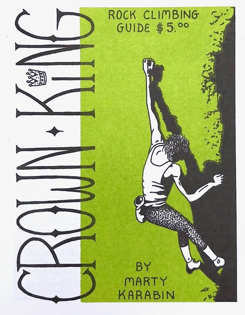
Crown King sports some of the best quality granite stone in the state. The best time to visit the area is in winter since the white granite domes face south. A few years ago a fire burned some of the vegetation at the Kingdome causing some damage to a few routes. The mine approach road has recently closed.
|
|
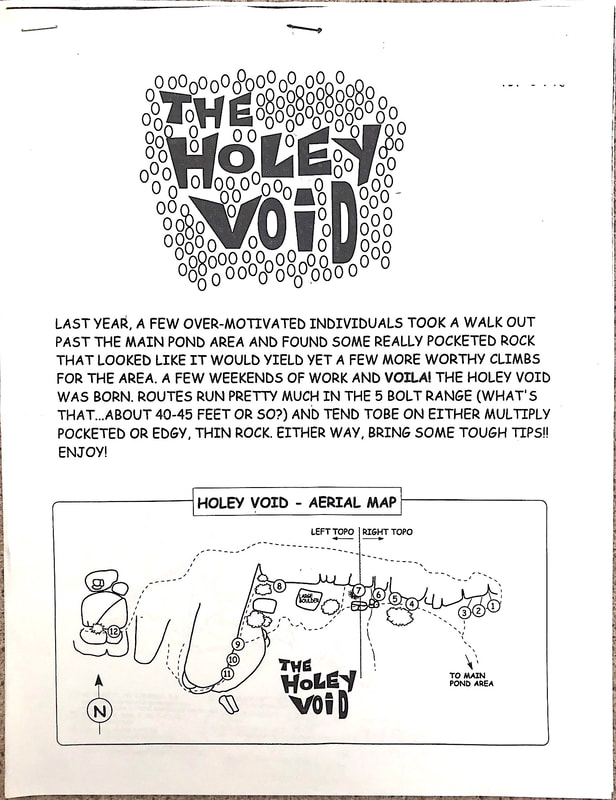
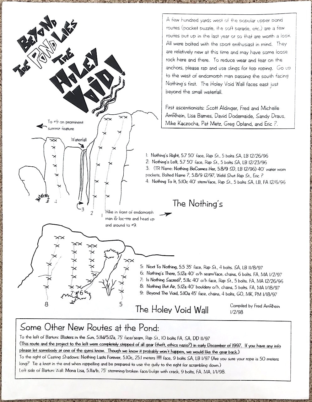
A new section of sport routes were added to the West end of the Pond in Queen Creek Canyon in 1996 - 1998. Since the Queen Creek Guidebook was already on the store shelves Fred AmRhein created The Holy Void guide to show routes in the new area.
|
Fred AmRhein 1/1998 |
|
6/1999 |
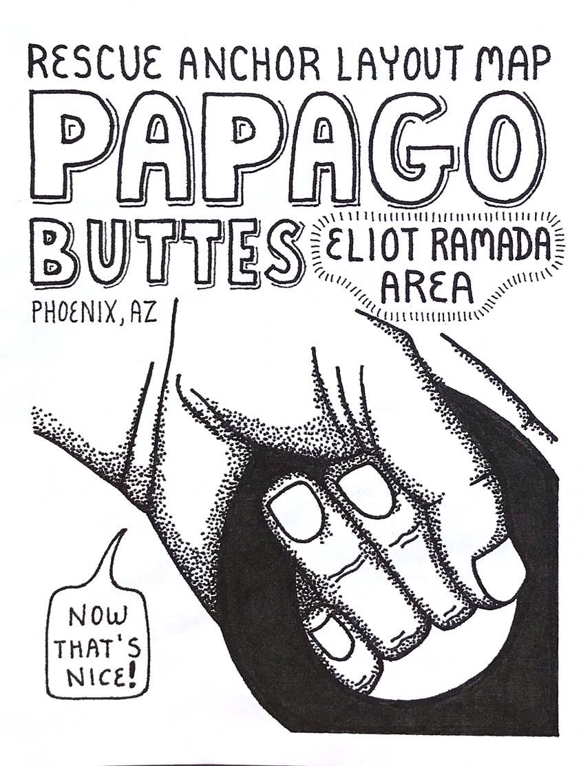
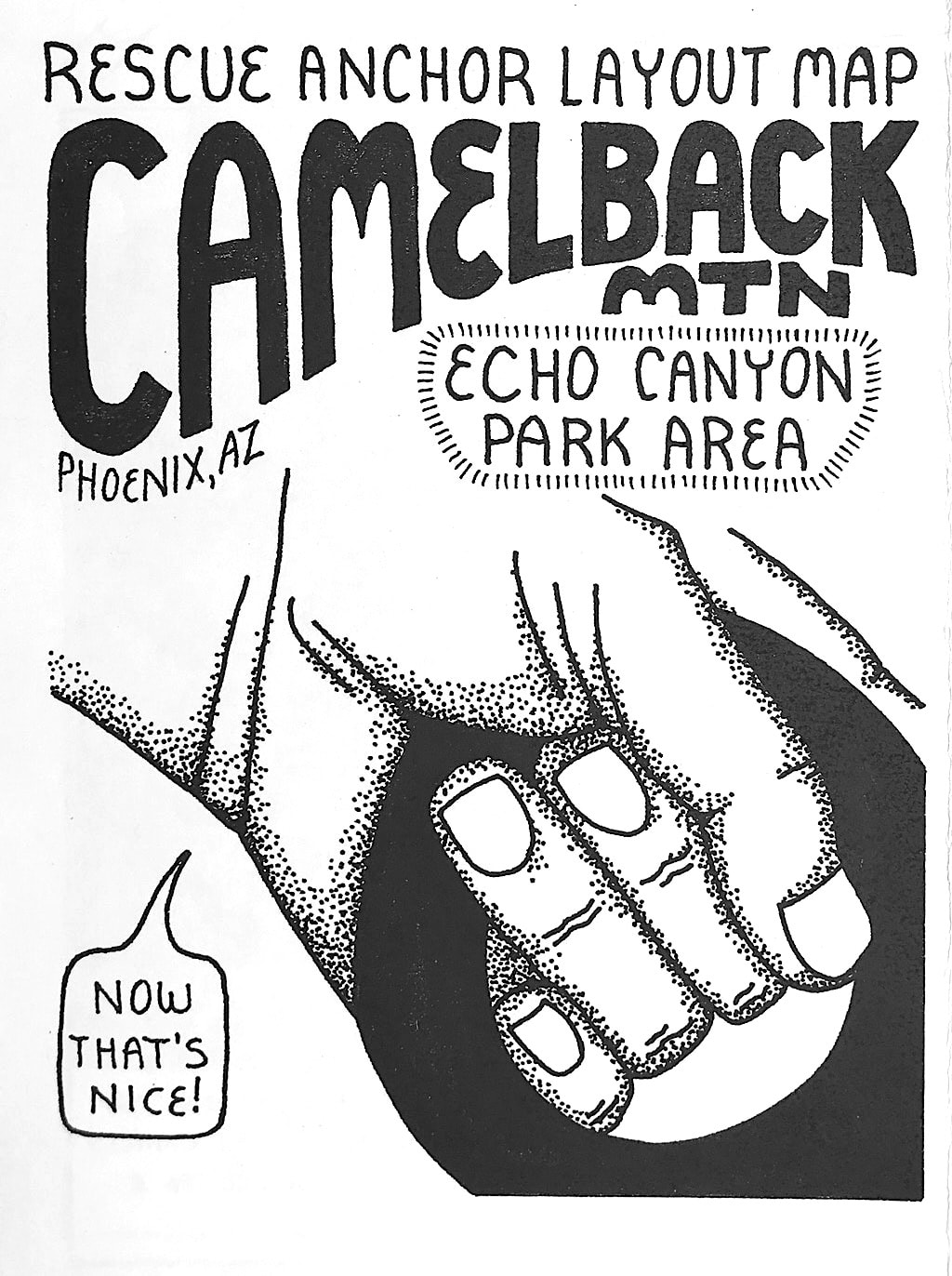
In 1999 I teamed up with the AZ Hiking Shack/ AHS Rescue to create a few rescue guides for the City of Phoenix firemen. Every once and a while a hiker/climber gets stuck on the mountain walls and a rescue is needed to get the stuck person back to safety. These guides were created to give the rescuers a idea of where the main rescue anchors are located, and the rope lengths needed to reach from the anchors to the ground. During this time main rescue anchors were added to the mountains to keep all climbers and rescue peoples safe.
|
12/1999 |
|
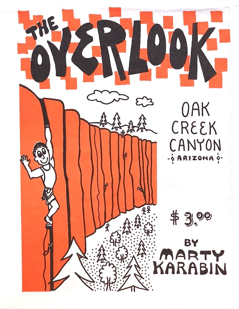
The Overlook is one of my favorite places to climb. Most of the routes are 100' in length and are all crack routes requiring trad gear to climb them. The basalt lava rock is very forgiving to the skin so most of the time no taping is needed as protection for the hand jamming. The approach is only five minutes and the Overlook sits on top of Oak Creek Canyon so the view is always amazing. I really enjoyed creating this guide!
|
8/2003 |
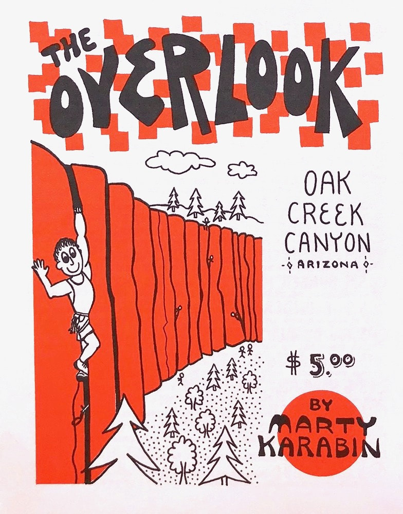
7/2008 |
10/2005 |
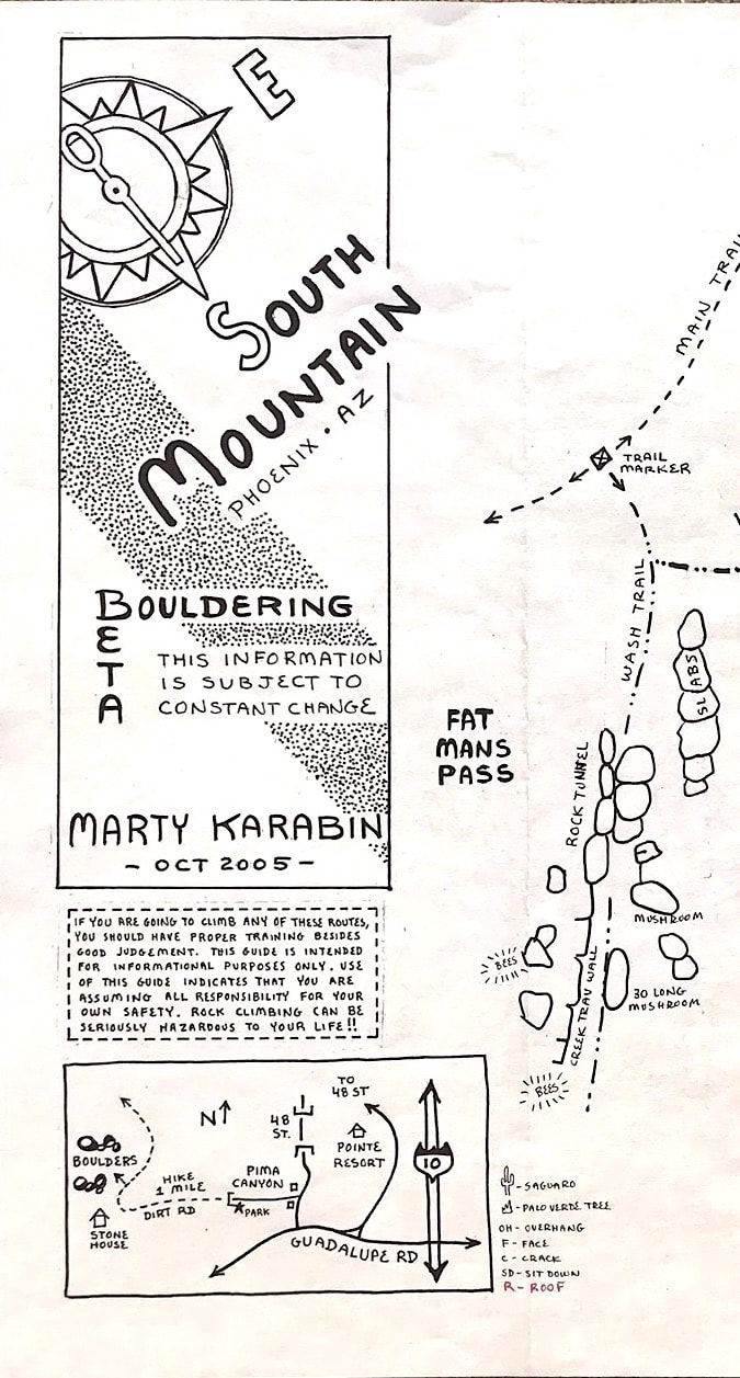
These are the beginning maps leading up to the South Mountain Pima Canyon guide. This area has seen many generations of climbers from the 1960s to present. Most of the climbing is bouldering that has perfect flat landings and the rock is in a wash so the quality is amazing. I added these versions to the Route Beta page of the MK Productions website since they also show boulder problems that have been climbed in Hidden Valley and Fat Mans Pass. Pima Canyon is also known for its many Petroglyphs on the rocks. The ancient art is nice to admire but please do not touch!
|
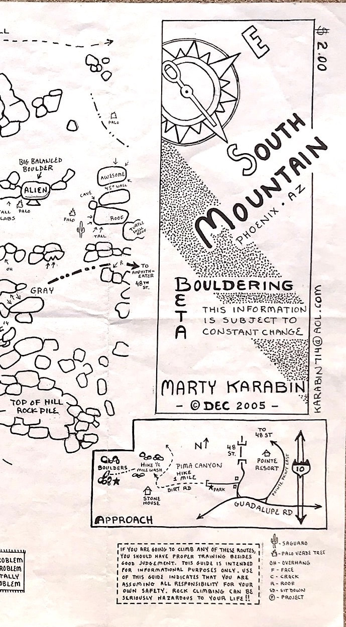
12/2005 |
|
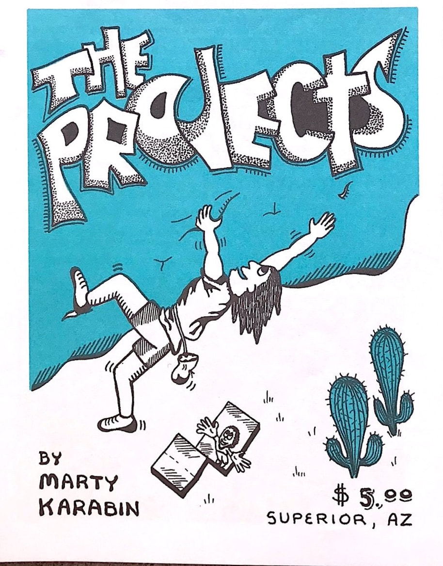
The Projects is a awesome beautiful small crag located just outside of Superior AZ. The rock is quartzite and it is incredibly solid providing awesome unique holds to climb on. The healthy saguaro cactus fills the hillsides surrounding the Projects area with Picketpost mountain and the Superstition mountain wilderness in the distance view. Parking is along the road but the approach is only 10 minutes. Two routes are still unsent possibly going into the 5.15 ratings.
|
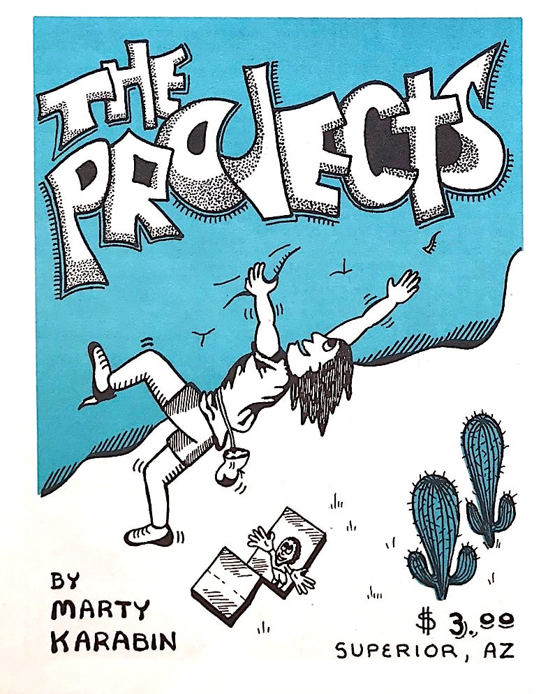
11/2005 |
11/2008 |
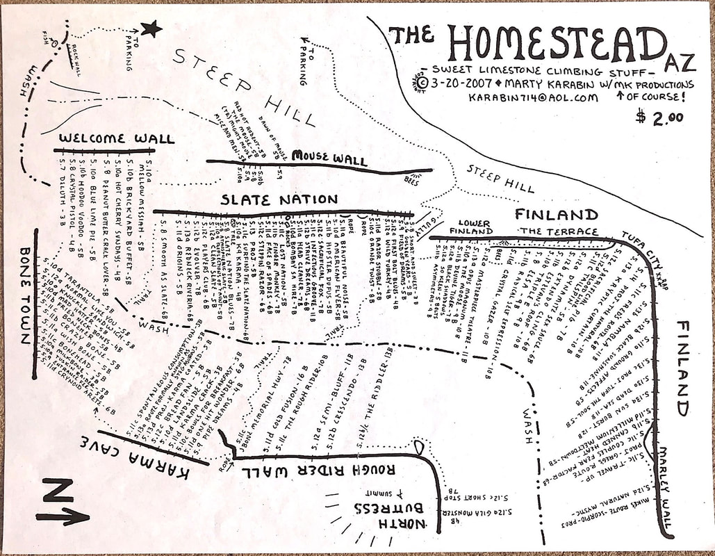
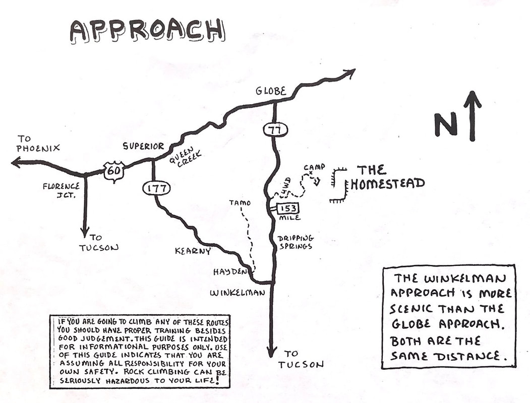
Homestead 3/2007 |
I created the Homestead guide as a update to the route development going on in the area. But so many routes were being developed so fast that the routes have doubled overall compared to what is shown presently on the guide. Go to Mountainproject.com for the most updated info to this area.
|
|
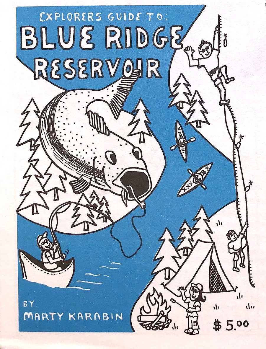
Blue Ridge Reservoir is a beautiful canyon filled with water year round. Limestone boulders are scattered throughout and hidden by tall pine trees. The Blue Wall sport area is easily accessed from the road, but many of the bouldering areas require a boat to reach them. My kids grew up camping and fishing at Blue Ridge.
|
9/2008 |
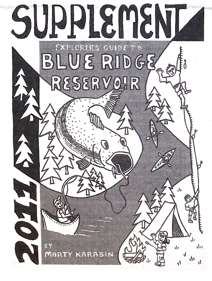
5/2011 |
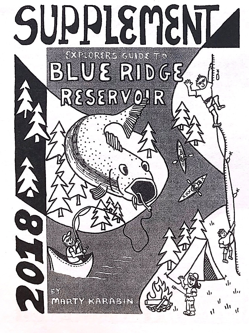
9/2018 |
10/2009 |
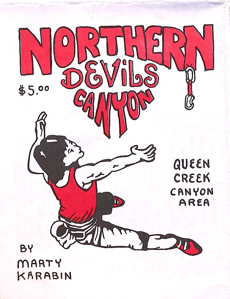
Northern Devils was a secret climbing area that myself and friends were developing for ten years before we let the secret out. It is located on the North side of Highway 60 North of Upper Devils Canyon. Mike, Rich and I put in hundreds of hours trying to keep the main trail open from the major vegetation growth that the canyon gets. The canyon requires a 1/2 mile hike to get into it but the hike is worth it. Many future routes still remain to be added to the 100 plus routes that the canyon already has. The Dacite rock quality is exquisite and there are many wildlife animals still living in the canyon. In the future the department of transportation shows a bridge being built across Northern Devils canyon which connects Superior to Top Of The World and onto Globe. Maybe at that time climbers will be able to access the canyon at some future pullout next to the newly constructed bridge.
|
11/2008 |
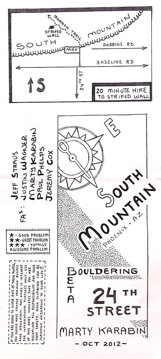
10/2012 |
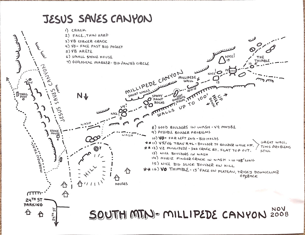
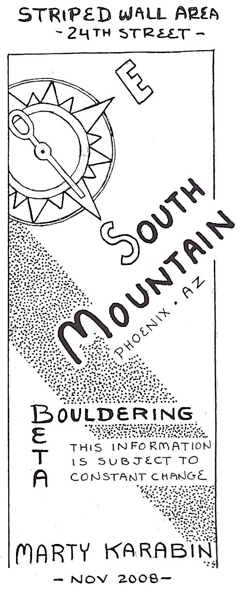
11/2008We started developing the South Mountain 24th street Striped Wall area in 2006 and the first guide was created in 2008. Many great boulder problems have been climbed and some of these guides have been shared as bonus prizes during local comps etc. The 2012 version is available, and the Jesus Saves/ Millipede Canyon info are both shown on Mountainproject.com. In 2019 many of the projects have been climbed and many new boulder problems have been added in both of these areas.
|
|
South Mountain Pima Canyon has seen many generations of climbers from the 1960s to present. Most of the climbing is bouldering that has perfect flat landings and the rock is in a wash so the quality is amazing. Pima Canyon is also known for its many Petroglyphs on the rocks. The ancient art is nice to admire but please do not touch! This guide was created in 2010 in conjunction with the City Of Phoenix Parks Department allowing climbers to be in the canyon. In the past this part of Pima Canyon was was considered off trail so for many years it was a toss up if climbers were recognized as a user group to the mountain. In 2016 the City of Phoenix Parks Division did a public input study of the entire South Mountain Park and allowed climbers and hikers to visit the beautiful Pima canyon wash as well as other new areas on the mountain. As a historical note: Pima Canyon actually ends at the stone house at the dirt roads end. From there as the trail drops into the wash, that is now considered part of Hidden Valley. Since the canyon is so well known as Pima Canyon, I left the Pima Canyon wordage on the guide map. But in reality the bouldering area is really located in Hidden Valley.
|
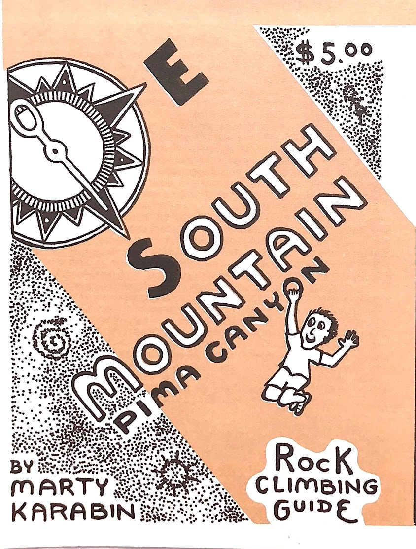
1/2010 |
|
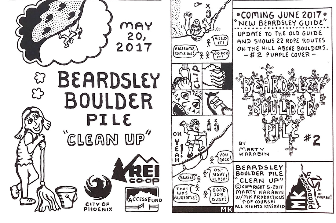
In 2017 and 2018 Scott McDaniel, REI, the Access Fund, and the City of Phoenix created a cleanup day for Beardsley Boulder Pile. Scott asked me if I could make some kind of collectable guide that people that attended would receive so I came up with a special guide that also introduced the newly revised Beardsley Boulder Pile guide. Since it was a cleanup I thought it will be perfect to have a character from the Carol Burnett Show on the front cover. The lady with a mop that was dreaming of climbing. The cleanup was a total success as 230 people attended in 2018 to clean the mountain from old trash from past years of abuse.
|
5/2017 |
6/2019 |
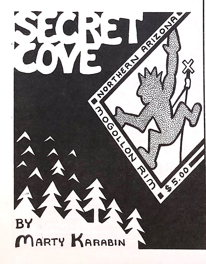
Secret Cove was a secret area I was developing that I would occasionally visit for ten years. I loved that I found a 140' tall sandstone wall that was easily accessible right off of the Mogollon Rim road. Most of the rock on the rim requires a grand adventure since there are not many trails that lead from the bottom of the canyon to the top. While I was developing the Island Wall I kept looking across the canyon at another wall thinking someday I will see if there are routes to be developed there as well. Then a few years ago I was approached by David Sampson and he mentioned he found a wall he put up a few routes on and was wondering if anybody else knew of the area. As it turned out he was developing one side of the canyon and I was on the other side. My routes outdated his so the name Secret Cove became the area.
|
|
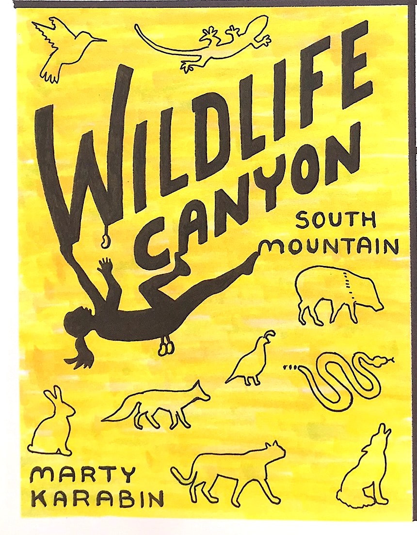
Throughout 2019 I was visiting a area of South Mountain a few days a week and fell in love with one of the canyons. Almost on every visit I was approached by some wild animals as they were just as interested in me as I was of them. I lost count of how many times I was chased up the hillsides by Javelinas, witnessed large packs of coyotes, rattlesnakes at my feet, and a friendly baby fox that would hang out with me as I was climbing. I feel very blessed to have been involved with nature at this level, and it was right here in the middle of a city of millions of people. I became more excited to hang out with the animals than to climb the routes. I rediscovered that peace is always around. I just need to slow down a little to recognize how close it is to me. I was hesitant on putting this guide on the store shelves since the parking to the area is within a subdivison of beautiful expensive houses. The less large groups of climbers becoming suddenly interested in Wildlife canyon will keep the animals around longer, instead of being chased out by a human invasion.
|
7/2020 |
..........................................................................................................
|
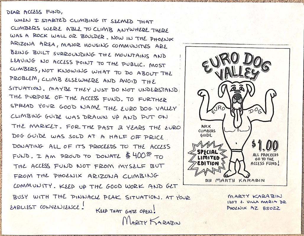
Euro Dog Valley's first mini guide raised $400 in donations to the Access Fund.
(Left) Sales store advertisement showing the different mini guides available at the beginning of 1996.
|